Tackling Tropical Climate: Understanding how diseases became the gateway to artificial climate

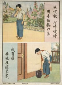
Eric Jennings chapter ‘Health Altitude, and Climate’ and his discussion surrounding malaria prevention methods within tropical climates brings forth another conversation regarding how contagious diseases may have been prevented within the same conditions. ‘Finding a viable escape from malaria and other tropical maladies was no trivial matter. Mortality for European soldiers and officials in Indochina remained on the order of 2 to 3 percent at the turn of the twentieth century.1 Victims of malaria were able to be sent back to France or over to Japan, but in terms of contagious diseases other precautions would have needed to be examined. An example of this would be the bubonic plague which was a major concern for the speed in which it could spread. As Jennings argues, hot climates are a major concern for bacteria growth because they thrive within those conditions. However, the difference between these two diseases is malaria becomes a concern when those vulnerable remain within the same environment, but for the bubonic plague and other contagious diseases, the biggest concerns are formed when the infected move away from their previous environment.

Trading ships were a predominant cause of contagious diseases being spread between countries. the close compact environment creates the perfect conditions for spreading diseases. In these cases, the most common precaution was to quarantine ports and to exterminate rats. ‘Southern Metropolis is cleaning up and ridding city of rats since plague scare.’2 Therefore, these instances throughout history give rise to concern regarding enclosed and densely populated spaces, especially when these spaces encounter a lack of sanitation protocols. Exposure to mosquitoes and rats that are contained within an environment in which malaria and the bubonic plague can thrive can become a matter of life and death, therefore, climate and environment as Jennings states was a vital aspect to research in order to understand the basic necessities for being able to remain within a tropical environment.

The new knowledge which enabled us to obtain ideal atmospheric conditions within buildings in tropical lands will have an even more remarkable effect of the transformation of these regions.’3

This coincides with Jennings other argument which centres around artificial climate. This type of climate allowed both the indigenous and Europeans to remain within a monitored space, which enabled them to remain healthy and away from any risks. Although Jennings only focuses on malaria, artificial climate has also proven useful of contained contagious diseases because the colder climate and high altitude created the perfect environment for not only deterring mosquitoes but for pausing bacteria growth.

He observed that children who had never left the plateau appeared healthy, while those who had travelled beyond it were sapped by malaria.4

These findings enabled the tropics to become liveable, while also influencing other forms of artificial climate to take root within public and private environments because of bed nets and air conditioning. ‘Captain Tyler put forward the idea for improving the condition of hot, damp air, which he showed could be done by lowering the temperature of a room below dew point; in effect, providing a hospital ward or sick room with artificial climate.5 Therefore, examples such as this highlight the evolving understanding of tropical climate and how studying altitude and climate can improve the understanding of health and hygiene. However, Jennings also provides a downside to these artificial climates due to the interior of these space being liveable, but once the occupants moved away from these spaces, they immediately became exposed to the raw climate conditions. It meant that space was still limited within the tropic, but it is undeniable that artificial climate still managed to create safe spaces to monitor and research malaria from a distance. Therefore, although diseases delayed progress within the tropics in terms of building settlements and expanding economies, what they did provide was a breakthrough within medicine and environmental control.

  1. Eric T. Jennings, Imperial heights: Dalat and the making and undoing of French Indochina (University of California Press, 2011) p.35. []
  2. The Cable News – American, Iloilo Fighting for Her Health (1912) p.3. []
  3. Hong Kong Telegraph, Artificial climate (1938) p.12. []
  4. Eric T. Jennings, Imperial heights: Dalat and the making and undoing of French Indochina (University of California Press, 2011) p.42. []
  5. Hong Kong Daily Press, Shanghai’s Damp Atmosphere (1912) p.8. []

The Impacts of Montesquieu’s Deterministic Arguments on Colonialism

Montesquieu’s book ‘The Spirit of the Laws’, published in 1750, focused on political theory and comparative law. However, within the book Montesquieu used the theory of environmental determinism (the belief that a region’s climate could affect the behaviour of the cultures living in it), to describe Asian history. The use of this debunked method shows how determinism was used by Europeans to project their power and modernity, and later to justify colonialism in the 19th century. This blog post will give an overview of how Montesquieu used environmental determinism to analyse Asia, and how this reflects European views on determinism.

Montesquieu argues that Asia’s geography is directly consequential for the hegemony and instability of major civilisations on the continent. This claim is ‘evidenced’ by the lack of a mountain range separating the north of the continent from the south, a function Montesquieu argues is served by the mountains of Scandinavia. To Montesquieu, the lack of a dividing range allows ‘hot’ and ‘cool’ regions to directly clash, contrasting with the more even gradient of European climates. The former was proposed to cause strong civilisations to border weak ones, which created unhealthy hegemony on the continent. Montesquieu concludes that ‘this is why liberty never increases in Asia, whereas in Europe it increases or decreases according to the circumstances’.

Montesquieu’s reasoning on this subject has been heavily debunked, but his writing opens a window into how central ideas of environmental determinism were to geographic thought in 18th century Europe. To Montesquieu, the entirety of Asian history could be explained by the dissonance present in the region’s climates – a dissonance which glosses over regional variation and other features present in the region like higher mountains and larger floodplains – both of which would have a greater impact on the mixing of cultures across the continent. Despite this, it was climate that was considered fundamental to the nature of societies, and as a result other factors are non-existent within his characterisation of Asia.

Montesquieu’s argument offers insight into how Europeans would use these ideas to justify colonialism taking place in the two centuries after the book was published. His conclusion that climate made Asia inherently unstable and illiberal would be used to justify colonialism, where a European power would take advantage of regional instability to set up a regime and crush dissent. As a result, the idea that climate meant that these regions would be governed no differently or worse without a European power in control, was central to justifying colonialism. Because of this, it is important to understand how environmental determinism began to be applied on a global scale, and was used to create a hierarchy of civilisations, to ensure that such discourse doesn’t become the norm in the future.

Source: Anne M. Cohler et al. (eds.) Montesquieu The Spirit of the Laws, Book 17 Ch3 – 8, pp. 279-284.

Festina Lente: The Foundation and Early Years of the Royal Hong Kong Golf Club 1888 – 1920

In 1857, on the banks of the Inverclyde River on the west coast of Scotland, a young boy was born who would grow up to be pivotal in the spreading of the Royal and Ancient game of golf to Asia. His name was Gershom Stewart, and the son of Andrew and Margaret would prove pivotal in expanding the game Eastwards. After moving south to the Wirral Peninsula in England and becoming a member of the Royal Liverpool Golf Club at Hoylake, he would take up a role in the East India trade. In 1882, this employment took the young man to Hong Kong. Shortly after, and with a stroke of luck, he encountered the Royal and Sutherland Highlanders, a golfing battalion who had arrived from Ceylon with a desire to ‘keep swinging’. Stewart’s everlasting affinity with Hoylake can be seen in the parallel motifs between the two clubs’ crests.

1   2


In May 1889, Stewart, working at the time for the Hong Kong & Shanghai Bank, put out a public notice in the press of the desire to establish a golf club in Hong Kong. The day after, thirteen men gathered at the Hong Kong Club on Queen’s Road, a vote was held and the Club was born into existence.

 3

The early golfing years of the Club were enjoyed, as with many other sporting societies in Hong Kong during this period, at the Racecourse at Happy Valley. The first ball was hit by James Lowson of Forfar, Scotland, in July 1890. A talented sportsman, Lowson enjoyed plenty of success in club competitions during the early years at Happy Valley. From the few photographs that survive from this period of the Club’s history, the Links, situated in the middle of the racecourse appears to have struggled from overcrowding. With only space for 9 holes, and with the land being shared for a number of different sports, the quality of the fairways and greens suffered. This was exacerbated by flooding issues and the building of a large pond which was designed and dug in as a relief mechanism. This resulted in a concerted effort from the Club to try and find a more suitable plot of golfing land.

Three years passed before a piece of land was found at Deep Water Bay and was designed and converted into a Par-30, 8 hole Links. It was a remarkable turnaround as competitions began to be held at the Bay course later that year in 1893. In 1897, a ‘grand plan’ came to fruition. The unassailable Gershom Stewart, with the help of his good friend Sir William Robinson, Governor of Hong Kong, requested as it was the year of Queen Victoria’s Diamond Jubilee, for Royal Charter. With celebrations all around the world, Royal Status was approved and 1897 marked the birth of The Royal Hong Kong Golf Club.

The Club would continue to grow in membership over the following years, with golfing life split between the Links at Happy Valley and at Deep Water Bay. In 1911, the Club looked once again outwards for greater space. Fanling Valley, much further north and close to the Chinese border was decided upon as a suitable location. With land carefully and meticulously allocated in the New Territories, getting approval for building a golf course was not an easy task. The Hon. Edwin Richard Halifax ‘an ally inside the Government’ proved to be a prize asset for the Club for his huge role in broking the deal which saw approval of the course’s building at Fanling in 1911. To this day, the Hong Kong Golf Club plays at both Deep Water Bay and Fanling.

 4

In 1918, during the historic Racing Carnival, disaster struck, and a great fire broke out at the Happy Valley Racecourse. Very sadly many people lost their lives and the Golf Clubhouse was destroyed. To this day, the disaster of 1918 remains one of the toughest days in the Club’s history.

However, the clubhouses and buildings at Deep Water Bay and Fanling are of great interest. As golf clubhouses always are, these buildings became active hubs of social life, and home to stories of golfing successes, blunders, mysteries and tales. Learning more about club life, the personalities, customs and practices would be a tremendously interesting project to undertake. Historians of golf in Asia, and in British colonies more widely, have revealed that a far more ‘liberal’ attitude to female members was taken and indeed there is evidence of this in Hong Kong, too. A ladies Putting Club is known of as early as 1904 and any research into RHKGC’s history should endeavour to learn much more about this.5

  1. https://www.golfweather.com/golf-news/royal-liverpool-to-host-2022-open/2418 []
  2. https://www.asiangolfconstruction.com/projects/hong-kong-golf-club/ []
  3. https://www.npg.org.uk/collections/search/portrait/mw97786/Sir-Gershom-Stewart?LinkID=mp79714&role=sit&rNo=0 []
  4. https://www.golfinhongkong.com/fanling-golf-club-new-course-review/ []
  5. The Hong Kong Golf Club, Along the Fairways of History, (2014) []

The Development of the Notion of Tropicality through European Mapping

This blog post will explore how an evaluation of European mappings of the Tropics illustrates the development of Europeans’ concept of tropicality. As David Arnold notes, tropicality has ‘come to signify the conceptualisation and representation of the Tropics in European imagination and experience.1 Early European mappings produced a notion of tropicality associated with marvel and spectacle. However, when I analysed later maps, the Tropics is presented based on increasingly positivist scientific observations illustrating what Arnold notes as a shift toward ‘scientific tropicality’.2 European perspective of the tropical world was almost exclusively maritime, which meant that their original visions of the Tropics were always from the deck of a ship.3 This distant perspective meant that their tropical mappings often centered the coastline and encompassed a conceived exoticism that suggests, as David Arnold explores, ‘the Tropics were invented quite as much as they were encountered’.4

An example of Arnold’s claim that in early Orientalist thought, the Tropics were represented as an exoticised landscape can be seen through Denis Cosgrove’s analysis of the map Terra Brasilis in the Miller Atlas.5 This map was created in 1519, during the second decade of European contact with the Tropics. As Cosgrove notes, the map ‘presents to the European vision a place for witness and wonder, not a place to dwell’.6 The map is entirely pictorial and features scenes of nature and indigenous people. There are varied and exotic trees with many exotic fauna, such as multi-coloured birds, parrots and parakeets.7 The only labels on the map are on the coast, naming ports and bays that could have been areas for colonial conquest. This choice of labelling only potential areas that were relevant for settlement purposes highlights the lack of knowledge early European settlers had towards aspects of the Tropics that were not immediately related to their colonising process illustrating how the European notion of tropicality was based on imagination and a ‘bourgeois vision’.8 As Cosgrove writes, ‘the image is unmistakably tropical’,9 emphasising how it was this pictorial ethnographical type of knowledge that the founded the early European notion of tropicality.


Atlas Miller « Facsimile edition

Terra Brasilis, detail from the Miller Atlas, 1519.

In comparison, Heinrich Berghaus’s map created in 1852 highlights how Europeans’ understanding and the notion of tropicality developed. As Cosgrove explains, Berghaus’s map ‘offers no explicit moral judgements about the various environments and people it represents’.10 It conveys a tropicality based on geographical science rather than pictorial images. The map’s positivist observations highlights how the geographical experiences of Europeans in the Tropics developed the previous imaginative tropicality that was evident in the Miller Atlas. It provides evidence for Arnold’s claim that the notion of tropicality had shifted to involve a more systematic and scientific understanding of the tropics.

Nahrungsweise—Volksdichtigkeit, insert map in Heinrich Berghaus, Geographische Verbreitung der Menschen-Rassen (1852)

Nahrungsweise—Volksdichtigkeit, Heinrich Berghaus, Geographische Verbreitung der Menschen-Rassen (1852)

Comparing these two maps illustrates how Europeans’ visions and understandings of the Tropics developed. Initially, tropical mapping was centered around ‘the romantic constructions of imaginative tropicality’.7 However, as expeditions to the Tropics increased so did knowledge of the Tropics and this was reflected in how mappings and thus the notion of tropicality became more focussed on geographical science.


  1. David Arnold, Tropics and the Traveling Gaze India, Landscape, and Science, 1800-1856 (Seattle (Wash.): University of Washington Press, 2014), 110. []
  2. Ibid., 112. []
  3. Felix Driver, Martins Luciana de Lima, and Denis Cosgrove, “11: Tropic and Tropicality,” in Tropical Visions in an Age of Empire (Chicago: The University of Chicago Press, 2005), pp. 197-216, 202. []
  4. Arnold, Tropics and the Traveling Gaze, p.5. []
  5. Driver, Luciana de Lima, Cosgrove, “Tropic”, p. 204. []
  6. Ibid., 205. []
  7. Ibid. [] []
  8. Arnold, Tropics and the Traveling Gaze, p. 6. []
  9. Ibid., 204. []
  10. Driver, Luciana de Lima, Cosgrove, “Tropic”, p. 208. []

The extended domestic space: the construction of nursing homes in pre-war Japanese society

Foucault’s The Birth of Clinic and Discipline and Punish triggered criticism and reflection on the institutions such as hospitals and mental asylum. The architectural design and administrative formats in these places were criticized for restricting and stripping the basic dignity of human beings. It is a similar case for nursing homes.

The history of the nursing home can be traced to the construction of poorhouses in England in the seventeenth century. It was specifically designed to contain and care for the marginal social collectives since, at that time, hospitals started to exclude the obstetrical, indigent, and insane patient, as well as lepers and children.1 Nursing homes originated from hospitals, which explains why their later construction and design adopted the structure of hospitals. The position of nursing homes in society is similar to hospitals as well. According to Roger Luckhurst’s chapter on prison, asylum and hospital in his work on Corridors, these places possess the characteristic of alienation, isolating from the social and familial environment.2 However, nursing homes in Japan in the pre-war time showed opposite attributes. They tended to recreate the domestic space for the aged through architectural construction and the arrangement of daily activities. In my long essay, I plan to focus on this unique characteristic of the nursing home in Japan.

The motivation for developing social institutions in Japan was similar to that of other Western countries (which is to take care of the life of the elderly), but the existence of nursing homes could be viewed as an exceptionally unusual case in East Asian countries which respected Confucianism as the dominant guideline for social behaviour and hierarchy. Taking care of the elders and seniors is the responsibility of the younger generations in a family. In Mika Toba’s report on the biographies of residents in a nursing home in pre-war Japan, we could know that most of them were people who either did not have a child or lost their child before coming to old age.  This sometimes even became a condition for the people who wanted to apply for residence in a nursing home. The Tokyo nursing home, which I mainly focused on, had a hut called “Family hut” (家庭寮). It was explicitly built for elderly people who still had family members of the same generation to live together. The set-up of the rooms in the family hut was intentionally designed in the same way as typical Japanese houses, “the structure of the hut only changes a little compared to a normal house. At the middle of the tatami room, there is a hibachi”.3 Not only was the physical construction made to be more similar to a traditional Japanese house, but the timetable arrangement also contained the intention to recreate everyday life regardless of following the concept of ‘nursing home’. Most of the hours in a day were designated to devote to housework. The timetable of the nursing home also aimed to give the aged as much freedom as possible. As long as the residents do not have a serious health issue, they have the freedom to go out.

Figure 1: the residents in the Tokyo nursing home receiving gifts from female students (caption on the left side: the visit of the female students delights elderly people)

Unlike the alienating nature of the hospital and mental asylum, the nursing home in Japan was closely connected with society. The Tokyo nursing home held regular visiting activities. In its anniversary book, there is a picture (figure 1) showing young students sending elderly people gifts. The arrangement of student visiting could be seen as compensation for the childless life of those elderly people. Since a Confucianist society operates on family units, these childless old people were seen as the social marginals included in the relief law enacted in 1932. The Japanese welfare system was established based on a family-like society. Nursing homes did not merely operate as shelters or medical supporting institutions for the elderly people in need, but instead as substitutions of a family for them.

Examining the domesticity in nursing homes on a broader scale, the development of the nursing home in Japan also marked the attempt of contemporary Japanese to explore an alternative way of Asian modernization instead of following the trajectory of the West. The first nursing home established in Japan was called St. Hilda nursing home and was operated by a Christian group in Japan. After the promotion of the Meiji emperor to support the people who needed social welfare in 1868, the number of nursing homes increased, and many of them were run by local religious groups, especially Pure Land Buddhism. The process of making the nursing home more like a domestic space reflects the attempt to seek an alternative path for the modernization of Japan on a social and domestic level. There is a relationship between the construction of the nursing home and the building of a modern Asian society based on the tenet of benevolence and Confucianism. Just like Jordan Sand argues that there was the dissolution of tradition and emphasis on domestic life, and the occurrence of this turn of dwelling and domestic spaces in the late Meiji and early Taisho period when Japan fully participated in global imperial competition was not just a coincidence.4

  1. Renée Rose Shield, Uneasy Endings: Daily Life in an American Nursing Home, Uneasy Endings (Cornell University Press, 2018), p.30-31. []
  2. Roger Luckhurst, Corridors: Passages of Modernity (London: Reaktion Books, 2019), p.190. []
  3. 東京養老院, ‘養老 : 東京養老院概要’ (東京養老院, 1938), p.76-77. []
  4. Jordan Sand, House and Home in Modern Japan: Reforming Everyday Life 1880-1930 (Cambridge, Mass.; London: Harvard University Press, 2005), p. 4-5. []

Long Essay Prospectus – The Hong Kong MTR as a Contested Space

The Hong Kong Mass Transit Railway, often abbreviated as the MTR, is one of the key focal points of the city, for better or for worse. It is often the subject of artistic endeavors that seek to capture the ‘essence’ of Hong Kong[1], used as synecdoche for the lived experience of the city[2] and used as a vehicle to define the city in a global context.[3] It is also a deeply political space – a space that has been at the centerpiece of much of Hong Kong’s political disputes in recent years. Most famously, the MTR has been sight of protests[4] during the city’s recent bouts of political unrest but has also been put at the center of less dramatic political issues – an example closely related to the 2019-2020 Hong Kong protests is that of the question of mainland jurisdiction over the Express Rail Link.[5]

Given the importance of the MTR, an examination of it as a contested space utilizing related spatial theory seems warranted and does not seem to have been performed yet in an academic context. Other, more well studied examples of contested spaces in South East Asia, such as Brenda Yeoh’s Contesting Space in Colonial Singapore could be used in order to provide points of reference and comparison.[6] The MTR itself is rife with room for spatial analysis, even outside of the context of investigating it as a contested space. For example, the MTR has a dedicated, long running project of integrating art into its stations, using the space as a place for exhibition.[7] Theories of messy urbanism[8] can also be applied to the Hong Kong MTR as a contested space, with incidents such as the aforementioned protests and a 2018 case of graffiti on the MTR representing some of the innate tensions of a messy urban environment.[9]

To sum up, I believe there is a strong case for a thorough investigation of the Hong Kong MTR as a contested space. There is a wealth of primary sources available – outside of the images of and reporting on the 2019, 2014 and 2003 Hong Kong protests, smaller scale incidents such as a dispute over musical instruments being carried in the MTR are also useful for this investigation.[10] Government and corporate statements on varying issues relating to the disruption of the MTR may also prove useful. As previously mentioned, there is a lack of existing academic work on the MTR as a contested space, but studies of other East Asian contested spaces may provide insight into the Hong Kong case. Finally, spatial theories, such as that of messy urbanism have obvious ways in which they can be applied to the Hong Kong MTR.

[1] HKFP Lens. ‘HKFP Lens: Helen Gray Sets out to Capture the Spirit of Hong Kong’s MTR… from Exit A1’. Hong Kong Free Press HKFP, 3 February 2019.

[2] Chung, Jack. ‘Officials Should Take the MTR Regularly to Understand Public Unhappiness’. South China Morning Post, 21 December 2021.

[3] Chan, Bernard. ‘In Praise of Hong Kong’s MTR – Still One of the Best in the World’. South China Morning Post, 17 December 2021.

[4] Leung, Hillary. ‘The Crisis Facing Hong Kong’s Subway System’. Time, 25 October 2019.

[5] Cheng, Kris. ‘Pro-Democracy Lawmakers Boycott Visit to Express Rail Link Terminus until Legal Questions Are Answered’. Hong Kong Free Press HKFP, 2 August 2017.

[6] Yeoh, Brenda S. A. Contesting Space in Colonial Singapore: Power Relations and the Urban Built Environment. NUS Press, 2003.

[7] MTR. ‘Art in MTR’. Accessed 8 October 2022. http://www.artinmtr.com.hk/.

[8] Chalana, Manish, ed. Messy Urbanism: Understanding the ‘Other’ Cities of Asia. Hong Kong University Press, 2016.

[9] Lai, Catherine. ‘MTR Train Covered in Graffiti Appears on East Rail Line during Peak Hours’. Hong Kong Free Press HKFP, 13 March 2018.

[10] Cheng, Kris. ‘Veritable Orchestra of Instruments Promised in Protest against MTR’s “selective” Enforcement of Bylaws’. Hong Kong Free Press HKFP, 25 September 2015.

Prisons as Internal and External Space: The cases of Lushun and Seodaemun


The study of prisons from a spatial aspect is an interesting one. There are the architectural studies, which analyse the shape of a building and never begin without first referring to the famous Bentham Panopticon, then there are the multitude of ethical and moral studies, as well as philosophical, historical, legal, the list goes on.

For my essay I am focussing specifically on two prisons under Japanese rule, Seodaemun in Korea and Lushun in Dalian (Manchuria, formerly Port Arthur). Both are brilliantly covered in Shu-Mei Huang and Hyun Kyung Lee’s work Heritage, Memory and Punishment: Remembering Colonial Prisons in East Asia. Their work covers all aspects of prisons, showing how prison architecture in east Asia developed through Western influences. Crucially, they show how this evolved not just in an architectural sense, but also in line with legal, judicial and penal reform itself.

What I am most interested in is the difference in prisoner treatment between Seodaemun and Lushun. As Huang and Lee state, Lushun was not originally built as a Japanese prison, but taken over after the defeat to Russia in the Russo-Japanese War in 1905. The plans for the prison had originally been drawn up by the head of the Russian Pacific Fleet, and so there is a clear visual demarcation in the architecture denoting the extent of the original Russian construction and the later Japanese additions.1 This is important to keep in mind, as Lushun was used to hold the captured Russian prisoners of war after 1905. Perhaps this was an attempt at keeping the prisoners aware of their defeat, but the accounts of those held there show that they were treated remarkably well. I argue that the location of Lushun in Manchuria is central to this, as it was seen as an already contested space- having gone variously through Russian, Chinese and Japanese control. Furthermore, the Russo-Japanese War was Japan’s first global conflict, and so Lushun represented Japan’s willingness to abide by the relatively new European treaties of human rights. I therefore argue that the treatment of prisoners in Lushun was not a case of Japan’s magnanimity to their fallen enemies, but a deliberate ploy to be viewed as civilised and modern by the rest of Europe, in order to prove their ‘enlightenment’ and modernisation.

The proof is clear when contrasted against the conditions and treatment of prisoners in Seodaemun prison. Unlike Lushun, Seodaemun was constructed by the Japanese imperial government after the signing of the Japan-Korea Protectorate Policy in 1905, which formally brought Korea under Japanese control2. It was therefore a clear symbol of Japanese Imperialism and their view of Japanese superiority. Huang and Lee argue that it was designed specifically to hold ‘“dangerous figures” such as political offenders’, with the ‘”objective” [own emphasis] of separating them from society’3. I argue that it was this viewpoint of the Japanese as superior to the Koreans that explains the mistreatment of those held in Seodaemun prison. Taking the spatial angle, it is clear that Seodaemun, being located in Korea and fully under Japanese control, was thus perceived as an ‘internal’ space compared to Lushun’s ‘external’ space.

  1. Shu-Mei Huang and Hyun Kyung Lee, Heritage, Memory and Punishment: Remembering Colonial Prisons in East Asia, Oxon, 2020, p. 57 []
  2. Ibid, pg. 76 []
  3. Ibid, pg. 77 []

Modern vs Traditional: Analysing sanitation efforts within China’s messy urban areas

‘China’s cities seem especially—in many respects increasingly—inhospitable to community self-determination and participation in environmental design’1

Urban Planning has proven to be difficult when accommodating a large population and according to Daniel Abramson within his article Messy Urbanism and Space for Community Engagement in China, there is a common theme of these urban areas becoming messy because of the lack of community engagement within urban development. However, to understand how messy urbanism is approached and improved, sanitation efforts enable a better insight as to how developers have been able to boost community spirt, while also cleaning up living spaces and streets. By the 1950’s China seems determined to clean up its urban spaces, and connect the public through the concept of being involved in improving sanitation together.

There are sanitation posters targeted at both children and adults to help them learn how to improve their hygiene and avoid the spread of diseases. These posters also provide insight towards Daniel Abramson’s argument which states that China would not follow the West in spreading out its population to smaller scale areas to avoid messy urbanism, instead he states that modernity was the point of interest rather than urbanity, and they were determined to push the cities into a modern state of living. Therefore, these posters from 1930 to 1950 show the progression of educating urban populations to enable the possibility of ridding the cities of messy urbanisation, while also allowing China to push towards its modern goal. To do this they needed social control of the population to enable these plans for larger streets and skyscraper buildings to become reality. Sanitation would change the state of minds and allow the community identity to accept the modernisation of their city. Below are two examples of how sanitisation was promoted towards children to catch germs and improve the living conditions of their homes.

Translation: I cover my mouth when I cough, and I spit into spittoon2

Translation: Let air circulate – open windows and doors in the morning3

‘Architectural chaos therefore also reflects a continuity and strength of community composition and identity. The coexistence of built-environmental disorder with community social order is extremely contradictory to the minds of professional planners and officials in China.’4

Furthermore, these plans to modernise China and allow space for wide streets and less enclosed living spaces could only go so far without demolishing Chinas traditional architecture. Instead, the traditional and modern began to coexist, which almost contradicted the idea of reducing messy urbanism. However, what can be argued is that through sanitation development and education, China improved its community values and enabled living spaces to change without changing. Those who lived within messy urban areas began to understand how to look after themselves and others to avoid spreading diseases, which would have been and still is a large concern within overpopulated areas. By regulating hygiene behaviours and introducing new sanitation protocols, messy areas could still modernise, while also being able to accommodate such a large population.

  1. Daniel Benjamin Abramson, Messy Urbanism: Understanding the “Other” Cities of Asia (Hong Kong University Press, 2016) p.218. []
  2. Hygiene Education for Children (U.S National Library of Medicine, 1950) []
  3. Hygiene Education for Children (U.S National Library of Medicine, 1935). []
  4. Daniel Benjamin Abramson, Messy Urbanism: Understanding the “Other” Cities of Asia (Hong Kong University Press, 2016) p.225 []

Cities as the frontier of propaganda: the creation of utopian/ dystopian space in Dalian in 1950s

Cities in Northeast China were critical locations for the industrial construction in the FFYP (the first five-year plan). Liaoning province was even called “the son of the republic”. As Liu Yishi demonstrates in his article, FAW became the icon of FFYP.1 Besides these physical constructions taking place in the Northeast of China, the construction of industrial cities also included the construction of propaganda and ideologies.  Propagandizing the spirit of revolution or revolutionary work was an important task for city planning. By referring to Bakhtin’s carnival sense of the world, I will demonstrate that the political propagandization comprised the carnivalization of public space, which led to the creation of dystopian space in China, especially during the period of Cultural Revolution.

In Liu Yishi’s Competing Visions of Modern, he quotes an article from Dongbei Ribao, a daily newspaper founded in 1945. It presents statistics on industrial production in the Northeast.2 With further investigation into this daily newspaper, one interesting phenomenon could be observed: the spiritual construction of citizens and industrial/ urban construction were treated equally in the socialist construction process in the Northeast. Many columns were devoted to explaining the importance of individual behaviour in maintaining sanitation and being a diligent worker in state-own enterprises. More on that, there were also patriotic education and lectures on the Party’s fundamental guiding principles.

Instead of only printing promotions in newspapers, cities were used as the media to spread these ideas. Two articles published in Dong Bei Daily Newspaper (Dong Bei Ribao) on 27 August 1950 discuss the importance of using the city as the centre to connect villages due to ‘its significant political influence on villages’ and how to exploit the function of cities in real life.  One article further explained that if a problem could be solved or figured out in the city, then surrounding villages could receive the same information so that problems would be solved thoroughly.3 The other article provided readers with eight specific methods which could be used in the propagandization work in Dalian. I will quote two of them here:

“Street radio – Radio is the best tool for propagandization/publicization in the city, it has great efficiency. Especially at the location where people gather, such as the shopping mall. Turning on the speaker, playing a CD first, attracting the attention of the masses, then giving a speech, but the speech needs to be concise and short, with incitation. Because people on the street are very mobile, some people leave, some people will come, and some will return. The speech could be repeated several times.”

“Festooned vehicle – using the festooned vehicles (big scooters or automobiles), hanging slogans around them, decorating them with beautiful flags, parading around. First, drumming attracts the public’s attention, then letting the publicist give speeches. After the speech, a short drama and peepshow could be following section.”3

The mutual characteristics could be derived: 1) the emphasis on the public space like streets and shopping malls; 2) the entertaining element in the process of propagandization, such as the short drama and the CD playing; 3) the political propagandization was hosted in a similar way to the celebration of festivals. These spatial practices match with Bakhtin’s carnival world, which includes the following characteristics: familiar and free interaction with people, eccentricity, carnivalistic mesalliance, and profanation.4  The gathering of a significant number of people in public locations blurs individual differences and makes ideas given by the speaker universal and applicable to all. Social hierarchy is eliminated. Everyone could be a part of the event. Public spaces also enable the occurrence of interaction and communication. The masses could react directly to the one giving the speech and communicate with many audiences surrounding them. However, this interaction is one-way since the audience cannot offer sophisticated and critical comments to the publicist. The only reaction they can give is either to cheer or to leave.

The addition of entertainment makes the masses subconsciously link political ideas and activities to drama, music and plays. Political propagandization is carried out in a format similar to operas and dramas. The request to use short, concise, and provocative language has a similar function to lines written by the playwriter to provoke the audience’s emotions so that they will experience the same feelings synchronously. Entertainment and the selection of public spaces where people’s everyday lives are carried out remind me of Zhang Jingsheng’s aesthetic society. In his Mei de shehui zuzhifa, Zhang proposed that music should be amplified and could be heard around the city, a subconscious form of education as people went about their daily routines.5 The political propagandization through radio and festooned vehicles are like Zhang’s music, played in the background of people’s everyday life, affecting them subconsciously. As L.A. Rocha states at the end of his article on Zhang’s urban theories, the aim of his utopian city was to reproduce the same minds and the same bodies.6 His aesthetics were basically authoritarian through and through.7 The underlying authoritarianism and the attempt to unify people’s minds could also be found in the propagandization work in Dalian.

This reshaping of public space later became the embryonic form of denunciation rally during the Cultural revolution from 1966 to 1976. While the core of this format of propagandization remained the same, the content upgraded from education of patriotism and internationalism to the public execution and criticism of people. Political propagandization was conceived as a kind of public performance. Public spaces become theatres and playgrounds. The seriousness was lost under that scenario, causing collective violence  more likely to happen. The utopian space, which could have been constructed if the masses learned from these teachings, transforms into a dystopian space where dehumanized activities and fearful behaviours take place, just like the performance of grotesque roles in carnivals if the political propagandization work is carried out in a carnivalized manner.

  1. Liu, Yishi. “Competing Visions of the Modern: Urban Transformation and Social Change of Changchun, 1932-1957.” Ph.D., University of California, Berkeley, 2011, p.117. []
  2. Ibid, p.111. []
  3. Dongbei Ribao, 27. August 1950. [] []
  4. “Carnivalesque” in Wikipedia, https://en.wikipedia.org/wiki/Carnivalesque [Accessed 15.10.2022]. []
  5. Leon Antonio Rocha, ‘A Utopian Garden City: Zhang Jingsheng’s “Beautiful Beijing”’, in The Habitable City in China: Urban History in the Twentieth Century, 2017, p.155. []
  6. Ibid, p.157. []
  7. Ibid, p.156. []

Blank Pages: The Great Kanto Earthquake and Japanese Occupied Manchuria

The Great Kanto Earthquake which leveled much of Tokyo and Yokohama in 1923 created an opportunity for reconstruction on an enormous scale and caused a shift in the population distribution as well as the aesthetic standards of the city.  The utopian approach to rebuilding Tokyo after the earthquake mirrors Japanese attitudes towards Manchuria while also serving as a stark contrast of utopian ideals.  

The event was described in the September 1923 issue of the American publication Japan Society as “The Greatest Disaster in History.”1 The earthquake and subsequent fire left “298,000 houses burned and 336,000 more shaken down,” in the journal’s initial report.2 A final estimate of its destruction was that around 45 percent of the structures in Tokyo were leveled, transforming it “from a bustling metropolis and imperial capital to a seemingly extinct city.”3 

4 

The scale of the destruction was interpreted at the time as “a moral wake-up call if not an outright act of divine punishment” but also, contrastingly, as a “golden opportunity.”5 At a time when utopianism and grand visions of urban planning were circulating in books like Ebenezer Howard’s Garden Cities of Tomorrow, the earthquake essentially rendered Tokyo a blank slate upon which to rebuild.  It literally flattened the city, creating “not only a unique, perhaps unparalleled opportunity to reconstruct Tokyo but the chance to arrest the perceived moral and ideological regress of Japan.”6 Efforts to not only reconstruct, but to renovate, beautify, and modernize Tokyo began.  By 1930 the products of these initiatives could be visibly traced on a series of maps produced by the Tokyo City Government which illustrated the results of projects dedicated to restoration and new construction of parks, schools, hospitals, roads, bridges, and electrical facilities.7 

8 

In addition to government efforts to rebuilt the city itself, the earthquake triggered a flight from the city center to the areas surrounding Tokyo, increasing the suburban population and decreasing the density of the city.  The suburb of Denenchōfu, planned and constructed in the years just before the earthquake, was modeled after the utopian vision of Howard’s garden city.  The timing of its construction (completed in 1923) and its location outside Tokyo caused its population to increase dramatically after the earthquake.9 This suburban population boom was widespread according to Japan Society’s December 1925 issue, which predicted that “Under the Greater Tokyo system, in which all of these suburban towns will be included in the City of Tokyo—and it is expected that this can be realized within the next decade or so—the City of Tokyo will have a population equalling that of London.”10

Denenchōfu serves as an example of the change in Tokyo’s population distribution as well as a new emphasis on the aesthetic qualities of the city’s spaces.  The architects of Denenchōfu placed a high value on the natural beauty of the development in accordance with Howard’s garden city ideal.11 The Tokyo government likewise invested in natural surroundings in its efforts to rebuild as evidenced by the excerpt in Japan Society’s May 1925 issue stating that “The Park Section of the Tokyo Municipality will plant 3,000 trees along streets in various sections of the city in May as part of the program to beautify the city.”12

This utopian conception of Tokyo post-earthquake as a blank slate on which to modernize infrastructure, disperse the population, and beautify the city parallels how some Japanese planners and intellectuals envisioned Manchuria.  The Japanese conquest of Manchuria after 1931, “provided a blank slate, or as city planners in Manchukuo put it, a white page, hakushi, on which ideal designs might be realized.”13 Ideal designs such as the Agricultural Immigrant Plan which envisioned utopian agricultural villages populated by Japanese farmers in northern Manchuria.14  In fact, “More than a few planners disillusioned by the resistance their plans faced in postearthquake Tokyo found planning on what they considered to be ‘blank pages’ in colonial Manchukuo more rewarding.”15 While the Agricultural Immigrant Plan was never realized, many architectural projects and modernization efforts were carried out in Manchuria.16 Like Tokyo after 1923, it served as a place in which to test utopian ideals.

Despite certain similarities in the conception of utopian plans, one of the stark contrasts between the “blank slate/page” of utopian planning in 1923 Tokyo and 1931 Manchuria was the ideology which accompanied it.  Unlike the aftermath of the Kanto earthquake in which the perceived “moral regress” included socialism, for those censored for their contrary politics in Japan, Manchuria offered a blank slate of a different kind.

  1. Japan Society, About Japan 1920-1928 (Internet Archive, 2021), https://archive.org/details/about-japan-1920-1928/page/n5/mode/2up. []
  2. Ibid. []
  3. Charles Schencking, “The Great Kanto Earthquake and the Culture of Catastrophe and Reconstruction in 1920s Japan”, in The Journal of Japanese Studies 34, no. 2: (Summer 2008), 296. []
  4. Zenjirō Horikiri, 1. Areas afflicted by the earthquake and fire disaster, places where fire broke out and circumstances driving the spread of the fire [map], Tokyo City Government, 1930, https://www.davidrumsey.com/luna/servlet/detail/RUMSEY~8~1~334402~90102430?qvq=q%3Apub_list_no%3D%2210808.000%22%3Blc%3ARUMSEY~8~1&mi=11&trs=38. []
  5. Schencking, “The Great Kanto Earthquake and the Culture of Catastrophe and Reconstruction in 1920s Japan”, 297. []
  6. Ibid., 297. []
  7. Zenjirō Horikiri, Teito Fukkō Jigyō Zuhyō, David Rumsey Historical Map Collection, Tokyo City Government, 1930. []
  8. Zenjirō Horikiri, 5. Program for the reconstruction of the imperial capital [map], Tokyo City Government, 1930, https://www.davidrumsey.com/luna/servlet/detail/RUMSEY~8~1~334398~90102426?qvq=q%3Apub_list_no%3D%2210808.000%22%3Blc%3ARUMSEY~8~1&mi=7&trs=38. []
  9. Ken Tadashi Oshima, “Denenchōfu: Building the Garden City in Japan”, in Journal of the Society of Architectural Historians 55, no. 2: (June, 1996), 146. []
  10. Japan Society, About Japan 1920-1928. []
  11. Oshima, “Denenchōfu: Building the Garden City in Japan”, 144. []
  12. Japan Society, About Japan 1920-1928. []
  13. David Tucker, “City Planning without Cities: Order and Chaos in Utopian Manchukuo”, in Crossed Histories (Honolulu, 2005), 55. []
  14. Ibid., 53. []
  15. Schencking, “The Great Kanto Earthquake and the Culture of Catastrophe and Reconstruction in 1920s Japan”, 323. []
  16. Louise Young, “Brave New Empire: Utopian Vision and the Intelligentsia”, in Japan’s Total Empire (Berkeley, 1998), 242. []