Korea through Terry’s (through the Imperial Japanese) Looking Glass

To borrow from Edward Said, whose writings occupy an almost exhaustive historiography on his own, “contrapuntal reading” in literature invites the reader to ponder writing actively says and does not say about one’s disposition and blind spots. Insofar as scholars agree that tourism both reflected and reinforced efforts to build and maintain overseas empires,1 officially-affiliated travel guidebooks are clear opportunities for discursive analysis of the “self” and “other.” The historiography of Japanese colonialism in Korea is no different.2 The concerted Japanese attempt to market the Korean peninsula for foreign revenue, I argue, is best evinced by Terry’s Japanese Empire.3 However, by examining the presentation of Korea within a Western-facing guidebook of Imperial Japan, I argue that the tenuousness of “Othering” in an “Occidental”-facing book evinces Hom’s clarification of imperialism as “textured by uneven gradations of sovereignty and sliding scales of differentiation that bind colonial past and imperial presence.”4

Firstly, Terry argues that Japan is as geographically and culturally specific as it is “typical” for an Oriental entity. This discourse is presented both in terms of climate and geography. On page lxi (of a 283-page long preliminary information section) Terry argues that it is ‘quite those of our dreams’ to see Japan and ‘learn its charm is equivalent to drinking the waters of Guadalupe.’ Contemporaneously, the Korean landscape is both littered with ‘limp and enervated Europeans from the torrid south’ while devoid of a ‘good gov’t to make it one of the most opulent countries of the gorgeous East.’ (698-99) In terms of culture, the text assumes fixed profiles of the tourist and those viewed by tourists. For Terry, there is a single, tourist profile of a traveller who has embarked on a long journey from Western Europe, Australia, or America, and the essentialism of the other even does not spare countries from the Mediterranean. Conversely, the object of the rigidly defined “Korean” man is impenetrable and physiognomically fixed. “[Like] the Chinaman, he has, in his fathomless conceit and besotted ignorance, a sturdy and unshakable faith in his own impeccability,” among other pejorative judgements. (719) This essentialist discourse appears indistinguishable from the liberal comparisons drawn to men from Spain and specifically South Italy insofar as poor cultural traits are concerned. In contrast, the Japanese man is “non-controversial and dignified” and Japan is made of ten different “native races [that] dwell within the Japanese Empire.” (clv-clvi)

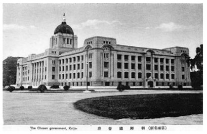
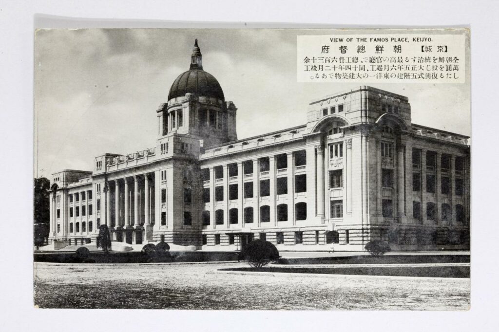
Yet, what Terry says about Korean history becomes problematised beyond the level of the “Occidental” perspective. On one hand, the hierarchy of civilisations is clear when Terry presents an entity characterised by corruption and ineptitude. Terry particularly describes the Three Kingdoms period as replete with each kingdom having (apparently) ‘episodes of national triumph and reverse,’ (bold is mine) and that the source of civilisation in Korea eventually derived from Japan. Yet, even this hierarchy was ‘only replaced in the latter half of the 19th cent. By the higher civilisation of Europe.’ (709) Finally, the Japanese ‘introduction of civilisation and enlightenment’ is a tangible process that can be tracked if one requests the Government General of Chosen’s ‘Annual Report on Reforms and Progress in Korea’.

On another level, Terry’s unabashed, liberal reference to Joseph H. Longford’s The Story of Korea reflects the ways in which imperial tourism refracts Japanese imperial knowledge about Korea. According to a publicly available copy of Longford’s 1911 text, Longford relied on the goodwill of the Japanese Ambassador, the Consul-General in London, as well as the Secretaries of the Embassy and Consulate-General “in elucidating obscure points in ancient history.”5 Longford’s preface sums up the confluence of two imperial interests: Japan converted “potentialities into realities of industrial and commercial wealth” as Britain invests in “the future status of our ally and in the political balance of the Far East.” The section on Korean history as a Japanese Protectorate reiterated the narrative of imperial salvation and modernity amidst Korean corruption and dysfunction.6

This analysis of a simple and almost uncritical presentation of the history of Korea in Terry’s guidebook shows how imperial texts have aligned to reinforce the Japanese imperial image of Korea, even as Japan was still subject to Terry’s Orientalist writing. Even in a colonial model of “Occidental” tourist-centric writing, this confluence of editorialising and knowledge transmission reinforces how Japan moderated and negotiated Orientalist treatment, leaving Korea twice removed from the mental hierarchy of Terry’s archetypal Western tourist.

  1. Shelley Baranowski et al., “Tourism and Empire,” Journal of Tourism History 7, no. 1–2 (May 4, 2015): 100–130. []
  2. Hyung Pai, “Travel Guides to the Empire. The Production of Tourist Images in Colonial Korea” in Laurel Kendall (ed.) Consuming Korean Tradition in Early and Late Modernity: Commodification, Tourism, and Performance (Honolulu: University of Hawaii Press, 2010), 65-87. []
  3. Philip Terry, Terry’s Japanese Empire: A Guidebook for Travellers (Boston and New York: Houghton Mifflin, 1914). []
  4. Shelley Baranowski et al., “Tourism and Empire,” 126. []
  5. Joseph H. Longford, The Story of Korea (London: T. Fisher Unwin, 1911), v-vii). []
  6. Longford, The Story of Korea, 351-365. []

Keen to be clean: Sanitation reforms in the “diseased city” of Colonial Keijō

Hygiene rituals in the city of Seoul – known as Keijō during the Japanese occupation – were formally institutionalised and led by police forces bi-annually during the Japanese occupation of the peninsula in 1910 until the end of Japanese occupation in 1945.  The power over sanitation and welfare policy was transferred from the Home Ministry of Sanitation Bureau to the Police Supervisory Board in 1912.1 This article will analyse the sanitation chapter of the Annual Report on Reforms and Progress in Korea by the Government-General in 1913-14 to outline the structural failings of colonial policy and the contradictory nature of government rhetoric which promised the assimilation of Seoul’s Korean citizens into a hygienic Japanese city and simultaneously implemented a Japanese-settler-centric programme of sanitation reform.2 The Governor-General of Seoul aimed to produce clean streets and active citizens who they wanted to condition into a habit of self-regulated cleaning. This article maps the enforcement of policed hygiene standards in Seoul’s densely populated residential areas and their racially charged origins.3 Although reports by the Police Supervisory Board imply that enforcing cleaning was introduced to encourage residents to associate cleanliness with their health, this assertion assumes prior knowledge that would enable the unification of cleanliness with health.4 In contrast, Korean newspapers make it clear that the monetary cost of non-compliance and the avoidance of aggravating the police force were the factors motivating residents, not a consciousness surrounding sanitation5

Government reports consistently reflect the Japanese officials’ prioritisation of the Japanese expatriate population, who were more susceptible to illness,  despite their relatively higher wealth level and capacity to install household waste disposal and hygienic food disposal, were at the forefront of policy and the construction of service to support sanitation improvements6 The Annual Report on the Reforms and Progress in Korea in 1913-14 highlights that a series of epidemic diseases broke out on the Korean Peninsula in 1913 like cholera, typhoid fever, dysentery, diphtheria and smallpox.  Whilst the report highlights that there was a 160-person decrease in the number of deaths compared to 1912, the report is clear that there is a significantly higher number of Japanese settlers who reported epidemic cases than Koreans. For example, 1,250 Japanese caught typhoid fever and 284 died, comparatively, 700 Koreans caught typhoid fever and only 86 died of the disease.7 The report’s data emphasises that colonial policy, which enforced police-imposed standards of hygiene,  aimed to protect Japanese settlers by mobilising the Korean population, rather than establishing constructive sanitation systems that would tangibly benefit Korean citizen and align with the government’s assimilation rhetoric.8

Chart from the Annual Report on Reforms and Progress in Korea 1913-14, Epidemic diseases in Choson

Figure 1: Chart explains the number of Japanese, Korean, and foreign people with epidemic diseases and the number of people who died from those diseases. Chart from the Annual report on reforms and Progress in Korea 1913-14.9

Furthermore, the report states that to tackle these epidemic diseases “qualified Japanese physicians [will be] attached to police stations to attend to public sanitation”. The draconian method of police enforcing semi-annual cleanups was an intrusive manner through which the government restructured Korean notions of cleanliness and government reports suggest that this was done with little resistance.10 However, evasion of government officials regularly occurred due to the implementation of hospital quarantine and the enforcement of a treatment plan for Koreans once they had informed officials of their symptoms. From a cultural perspective, Koreans also deeply feared dying outside of their homes because this was a space where they believed spirits could come to venerate them after death.11  An overarching insensitivity to the social and cultural consciousness of Korean citizens curbed the efficiency of colonial policy and directly contradicted the government’s assimilation project. This can be illustrated further in the measures taken to sanitise the streets and sewage systems of Korean populated areas of Seoul.

The reports served the government by reconstructing national understandings of city management by delegitimised Korean notions of health and sanitation. In section 122, the report states that “numerous natives who only know old-fashioned Chinese methods and nothing of modern medical science”. In contrast to the government’s proliferation of Korean incompetence, the Seoul Sanitation Association (SSA), directed by the Residency-General, imposed a fee for excrement collection on the city’s Korean population when Korean fertiliser merchants were completing their task more effectively and free of charge.12 Resultantly, newspaper interviews reflect that waste was collected much less frequently, exacerbating hygiene issues whilst rural farmers suffered a resource deficit in manure.13 The SSA enforced using a top-down approach to managing sanitation which ignored the knowledge of seasoned local professionals and citizens, resultantly, many Koreans failed to pay their share due to poverty in the region and fears it was a financial fraud due to this service already being provided by local fertiliser collectors. Henry highlights that either a heavy fine or labour instead of a wage would be requested if the two sen fee was not paid.14 These policy’s did not focus on the integration of Koreans through education suited to their understandings of sanitation or the use of methods which respected the privacy of Korean people, instead, these policies ritualised cleaning and fee paying which the government felt would help to curb the infection rate of the expatriate population. Although sanitisation cooperatives and talks surrounding education on sanitation were set up partly to educate the population, their association with police enforcement significantly impacted engagement with these groups and ultimately decreased the effectiveness of lectures and other communication techniques imposed on the Korean population.

In conclusion, Henry argues that the evident subordination of Seoul’s Korean population during Japanese colonial governance is illustrative of the continual privileging of the Japanese settlers and the hegemony of the pervasion of the euro-asian power-knowledge concept into their style of colonial policy.15 Despite the Governor-Generals insistence that the aim was to assimilate the Korean peninsula into Japanese society, medical reports and municipal government data highlight that the production of knowledge regarding the causal relationship between the city’s sanitation infrastructure and the knowledge Seoul’s colonised residents had regarding sanitation was constructed to present the Japanese as superior in their understanding of health.16 Using partial knowledge of pre-established sanitation efforts used by Korean’s to ‘solve’ the city’s sanitation issues, the colonial government diagnosed the so-called “diseased city” of Keijō with issues that were only exacerbated by their presence.

  1. Todd A. Henry, Assimilating Seoul: Japanese Rule and the Politics of Public Space in Colonial Korea, (Berkley, 1972), p.137. []
  2. Governor-General of Chosen, Annual Report on Reforms and Progress in Korea by the Government-General in 1913-14, (Seoul, 1915), pp. 123 -131, Accessed at: https://archive.org/details/annualreportonreformsandprogressinchosenkorea191314/page/n171/mode/2up (Accessed on: 6/11/2023). []
  3. Henry, Assimilating Seoul, p.136. []
  4. Ibid, p.139. []
  5. Ibid.  []
  6. Ibid, p.155 []
  7. “Report on Reforms and Progress in Korea 1913-14”, Accessed at: https://archive.org/details/annualreportonreformsandprogressinchosenkorea191314/page/n171/mode/2up, (Accessed 6/10/2023), pp.125 []
  8. Henry, Assimilating Seoul, p.131. []
  9. Annual Report on Reforms and Progress in Korea 1913-14, pp.123-131. []
  10. Henry, Assimilating Seoul, p.139. []
  11. Ibid, p.142. []
  12. Ibid.p.135. []
  13. Ibid, p.136. []
  14. Ibid. p.135. []
  15. Ibid. p.139. []
  16. Ibid. []

Prisons as Internal and External Space: The cases of Lushun and Seodaemun


The study of prisons from a spatial aspect is an interesting one. There are the architectural studies, which analyse the shape of a building and never begin without first referring to the famous Bentham Panopticon, then there are the multitude of ethical and moral studies, as well as philosophical, historical, legal, the list goes on.

For my essay I am focussing specifically on two prisons under Japanese rule, Seodaemun in Korea and Lushun in Dalian (Manchuria, formerly Port Arthur). Both are brilliantly covered in Shu-Mei Huang and Hyun Kyung Lee’s work Heritage, Memory and Punishment: Remembering Colonial Prisons in East Asia. Their work covers all aspects of prisons, showing how prison architecture in east Asia developed through Western influences. Crucially, they show how this evolved not just in an architectural sense, but also in line with legal, judicial and penal reform itself.

What I am most interested in is the difference in prisoner treatment between Seodaemun and Lushun. As Huang and Lee state, Lushun was not originally built as a Japanese prison, but taken over after the defeat to Russia in the Russo-Japanese War in 1905. The plans for the prison had originally been drawn up by the head of the Russian Pacific Fleet, and so there is a clear visual demarcation in the architecture denoting the extent of the original Russian construction and the later Japanese additions.1 This is important to keep in mind, as Lushun was used to hold the captured Russian prisoners of war after 1905. Perhaps this was an attempt at keeping the prisoners aware of their defeat, but the accounts of those held there show that they were treated remarkably well. I argue that the location of Lushun in Manchuria is central to this, as it was seen as an already contested space- having gone variously through Russian, Chinese and Japanese control. Furthermore, the Russo-Japanese War was Japan’s first global conflict, and so Lushun represented Japan’s willingness to abide by the relatively new European treaties of human rights. I therefore argue that the treatment of prisoners in Lushun was not a case of Japan’s magnanimity to their fallen enemies, but a deliberate ploy to be viewed as civilised and modern by the rest of Europe, in order to prove their ‘enlightenment’ and modernisation.

The proof is clear when contrasted against the conditions and treatment of prisoners in Seodaemun prison. Unlike Lushun, Seodaemun was constructed by the Japanese imperial government after the signing of the Japan-Korea Protectorate Policy in 1905, which formally brought Korea under Japanese control2. It was therefore a clear symbol of Japanese Imperialism and their view of Japanese superiority. Huang and Lee argue that it was designed specifically to hold ‘“dangerous figures” such as political offenders’, with the ‘”objective” [own emphasis] of separating them from society’3. I argue that it was this viewpoint of the Japanese as superior to the Koreans that explains the mistreatment of those held in Seodaemun prison. Taking the spatial angle, it is clear that Seodaemun, being located in Korea and fully under Japanese control, was thus perceived as an ‘internal’ space compared to Lushun’s ‘external’ space.

  1. Shu-Mei Huang and Hyun Kyung Lee, Heritage, Memory and Punishment: Remembering Colonial Prisons in East Asia, Oxon, 2020, p. 57 []
  2. Ibid, pg. 76 []
  3. Ibid, pg. 77 []

Imperial Tourism: A Comparison of Japanese Postcards of Colonial Korea

Spatial politics were central to the maintenance of Japan’s imperial empire.[1] A historical examination of tourism allows for analysis of how territory and geographical space were stabilised in the imagination of the Japanese public during the early 20th century. This blog post will explore the potential for understanding postcards as representative of historical mobility across this geographical space, both imagined and real. It will demonstrate this through comparing Japanese depictions of Korea through picture postcards produced in the colonial period. The arguments and ideas put forward in this post will form the basis of a longer analytical essay, and thus will aim to introduce the topic, highlighting potential areas for further development and synthesis.

“[Postcards] seem like shards of flash-frozen reality compacted into two dimensions, putative proof of having been there and seen that. They move over various forms of distance and time, while carrying with them ephemeral yet precious moments or sights to be appreciated, and then possibly forgotten.”[2]

There is a tendency in historical academia to treat postcards straightforwardly as either merely an embellished form of communication or simply a visual record, in much the same way as historical photographs. Whilst postcards do provide a valuable pictorial insight into the past, Hyung Gu Lynn argues that frequently scholars focus on the “aesthetic elements of the image” of postcards and neglect the socio-political context which an examination of their creation, distribution, and reception can allude to.[3] I argue that postcards inhibit both a sense of traversing space and traversing time. The sender of the postcard has travelled to an ‘unfamiliar’ space in order to purchase and post it back home. This is implicit in the meaning taken from the physical postcard itself, but also in the spatial imaginary it creates of the places photographed; thus the postcard has traversed space. Likewise, due to the nature of the postal service there is a passing of time between the act of the sender posting the card and it being received at its intended location; thus the postcard has traversed time. As Lynn states: “the postcard allowed for a journey into the afterglow of the recent past.”[4]

With this understanding, I will now compare three postcards of colonial Korea that, when analysed together, present a narrative of Japanese rule that emphasises colonial modernity. They are taken from the collection “The Views of Keijo.” Originally a 32 postcard set from the 1940s, only 29 of the postcards survive today.[5] The three postcards below all depict colonial Korea, but in dramatically different lights. Lynn argues that known changes to the urban landscape helps to place postcards (that often go undated) in time.[6] For example, the Government General Building in Seoul, Korea, was the subject of many postcards following its construction in 1926, as can be seen in the postcard below:

[7]

This postcard emphasises the modern architecture of the Government General Building, which sits on the previous site of the Korean Gyeongbok Palace. The demolition of valuable Korean historical and geomantic sites was a key facet of the Japanese occupation. In particular, new and modern Japanese buildings were located strategically and purposefully on old Korean sites. Part of the previous site was often left in ruins alongside the colonial site to demonstrate Japanese superiority.[8] These archaeological areas were then constructed into tourist spots, allowing the Japanese to select a specific representation of premodern Korean culture and civilisation to show the wider public.[9] The second postcard demonstrates this, depicting Gyeonghoeru Palace Hall:

[10]

In the picturing of these two locations in the format of postcards, Japanese forces could demonstrate to the wider Japanese, Korean, and international public their colonial strength and achievements, as well as transforming premodern Korea into a voyeuristic object rather than a lived reality. Combined, this created colonial Seoul as a desirable tourist destination.

In contrast, the third postcard shows the Korean neighbourhood located outside Seoul’s East Gate:

[11]

Postcards such as this, which displayed the thatched roofs of a Korean neighbourhood, helped to reassert a discourse of progress, or lack thereof, through comparison of these spaces with ‘modern’ Japanese buildings.[12] According to these postcards, which were placed alongside one another in a collection, modernity is presented as a result of colonial rule. This narrative implies the upward development of Japanese innovation in comparison to the illustrations of Korean society as in stasis.[13] Furthermore, the Korean people pictured in the postcards become themselves the object of touristic voyeurism and attraction.[14]

“This set of postcards nicely represents three themes typically encountered by Japanese visitors to Korea around 1940, namely examples of modernity introduced by the Japanese, evidence of Japanese efforts to preserve examples of Korea’s “once advanced civilization,” and evidence of the still primitive contemporary native culture.”[15]

Moreover, Lynn argues that colonial postcards “helped portray the colony as a place that was desirable because of its distance, its picture postcard exoticism.”[16] Through postcards, the imagined space of colonial Korea became closer to the Japanese metropole centre, and movement between the two was implied as easily achieved through modern technologies such as ship, rail, and post. At the same time, these postcards painted Korea as consisting of people culturally different (read: backwards) compared to the Japanese people receiving the cards at home.

There are several potential analytical areas around historical postcards which, if developed, would provide further insight into how they are representative of spatial mobility. For instance, the majority of postcards in surviving archival records are cards that remained unsent, likely being donated as a collection.[17] This speaks to the purpose of the cards as beyond simply stationary or for communicative means, suggesting they were tokens worth collecting and preserving. This, however, begs the question; is there more value to those historical postcards which were posted? In terms of examining their mobility, does the act of the postcard itself physically crossing geographical distance (and their rarity now) make it more valuable of study than those which were simply bought and collected? Such questions provide a useful starting point for further academic investigation of the topic.


[1] MacDonald, Kate (2017) Placing Empire: Travel and the Social Imagination in Imperial Japan, Oakland: University of California Press, p. 2

[2] Hyung Gu Lynn (2007) ‘Moving Pictures: Postcards of Colonial Korea,’ IIAS Newsletter, 44: 8

[3] Ibid, p. 8

[4] Ibid, p. 8

[5] Ruoff, Kenneth J. (2010) ‘Touring Korea,’ in Imperial Japan at Its Zenith: The Wartime Celebration of the Empire’s 2,600th Anniversary, Cornell University Press, p. 109

[6] Lynn (2007) p. 8

[7] The Government General Building in Seoul, taken from the collection “The Views of Keijo,” as in Ruoff, Kenneth J. (2010) ‘Touring Korea,’ in Imperial Japan at Its Zenith: The Wartime Celebration of the Empire’s 2,600th Anniversary, Cornell University Press, p. 110

[8] Yoon Hong-Key (1988) ‘Iconographic Warfare and the Geomantic Landscape of Seoul,’ in The Culture of Fengshui in Korea: An Exploration of East Asian Geomancy, Lexington Books, p. 281

[9] Ruoff (2010) p. 109

[10] Gyeonghoeru Palace Hall, taken from the collection “The Views of Keijo,” as in Ruoff, Kenneth J. (2010) ‘Touring Korea,’ in Imperial Japan at Its Zenith: The Wartime Celebration of the Empire’s 2,600th Anniversary, Cornell University Press, p. 110

[11] Korean residential neighbourhood in colonial-era Seoul, taken from the collection “The Views of Keijo,” as in Ruoff, Kenneth J. (2010) ‘Touring Korea,’ in Imperial Japan at Its Zenith: The Wartime Celebration of the Empire’s 2,600th Anniversary, Cornell University Press, p. 111

[12] Lynn (2007) p. 9

[13] Ibid, p. 9

[14] Ruoff (2010) p. 111

[15] Ibid, p. 111

[16] Lynn (2007) p. 9

[17] Ibid, p. 8

Geomantic Warfare: The Japanese General Government Building in Seoul

Gyeongbok Palace was originally built in the 14th century as the centre of Joseon Dynastic rule in Seoul, Korea. The first king of Joseon constructed the palace as both physically and symbolically representative of the auspiciousness of his rule. This, in turn, bolstered the legitimacy of the dynastic change and helped to naturalise the movement of the capital from Kaesong to Seoul.[1] This process was deeply influenced by concepts of pungsu, or ‘geomancy’ in English; “traditional ideas and practices concerning the relationship of human beings with the surrounding environment.”[2] Geomantic ideals were utilised in order to emphasise the good geographic placement of Gyeongbok Palace and of the surrounding landscape to the people, which helped the ruling elites to solidify their power. Following the annexation of Korea in 1910, the Japanese defaced the Gyeongbok Palace site in an attempt to accentuate their own power and naturalise the authority of their colonial rule. Most importantly, they manipulated Korean geomantic ideals to reinforce this, and constructed their General Government Building on the palace grounds.[3] How they engaged in this ‘geomantic warfare’ is what I will explore in this post, making use of historical photographs to do so.

The Japanese colonial government carefully examined the geomantically auspicious sites of Korea, and then ruined and occupied the sites by replacing Korean buildings with Shinto shrines or Japanese government buildings.”[4]

In The Culture of Fengshui in Korea, author Hong-Key Yoon employs the cultural-geographic approach of “reading landscape as a text like a book” to analyse the site of Gyeongbok Palace.[5] Yoon writes about the changes to this cultural site across the 20th century, and examines how ideologies and power relations were built into the meanings taken from these physical geographic changes. Geomantic interpretations were central to this, and Yoon argues these social constructions were used to artificially reinforce popular beliefs about specific landscapes.[6]

Archival photograph showing the construction of the Japanese General Government Building in front of Gyeongbok Palace.[7]

 The Japanese General Government Building in Seoul was built in 1926 by the Empire of Japan as the central administrative headquarters of their colonial rule over Korea. The building was constructed over the site of Gyeongbok Palace, widely renowned as one of Korea’s most auspicious and important cultural locations. Yoon explains how the Japanese used a method known as ‘palimpsest’ in order to naturalise their new colonial icons. This involves a deliberate comparison of a new “strong” icon against an old “weak” icon.[8] In the case of the Gyeongbok site, the Japanese did not completely replace the Palace with their own building.[9] Rather, they left part of the ruins in place to the back of their new building (an area which, according to geomantic interpretations, is unfavourable). The General Government Building towered over the Palace in both physical height and symbolic strength. This deliberate visual comparison of the two powers represented here had a clear interpretation: Japan was strong, Korea was weak.

Archival photograph of the former Japanese General Government building located in front of Gyeongbokgung Palace in central Seoul (source: Busan Museum).[10]

 The Japanese were said to have deliberately disrupted the geomancy of the Korean site in an attempt to legitimize their power and de-legitimize Korean nationalism. During the debate in the 1990s over whether the General Government Building should be demolished, there was a widespread public discourse that the building had been the leading weapon in a Japanese plot to deliberately block Korea’s national energy (as encapsulated in the Gyeongbok site).[11] This was proliferated by the discovery of “Japanese spikes” under the site of the building during the demolition process;

These spikes were 20 to 25 centimetres in diameter and 4 to 8 metres in height, and they were tightly packed, about 60 centimetres apart from each other. (Dong-a Newspaper, 29 November 1996).”[12]

A photographic example of similar Japanese spikes supposedly found by activists between 1995 and 2001 in the Jirisan National Park.[13]

The spikes were driven into the ground supposedly as part of the building’s foundations but, in the mind of the Korean public, they were a purposeful attempt to suppress the “earth-energy” of Joseon’s finest palace.[14] Without the nationalistic geomantic interpretation of what these spikes represented, their findings would have otherwise been of little note to the Korean public. Although, it is important to note that whilst the argument that the Japanese purposefully constructed their General Government building in order to destroy the geomancy of Gyeongbok palace is widely accepted, the argument that Imperial Japan deliberately fixed these iron spikes into the ground as part of this remains controversial.[15] 

Yoon argues that geomancy was not the cause of this battle over the Gyeongbok landscape.[16] Rather, the geomantic interpretations taken from the actions of these two powers (and the buildings represented by them) were used and manipulated in order to achieve various political aims, and to legitimize and de-legitimize support for Imperial Japan in the Korean public mindset throughout the 20th century.


[1] Yoon, Hong-Key, ‘Ch15 Iconographic Warfare and the Geomantic Landscape of Seoul’, in The Culture of Fengshui in Korea: An Exploration of East Asian Geomancy, Lexington Books (1988): p. 283

[2] Han, Jung-san, “Japan in the Public Culture of South Korea, 1945-2000s: The Making and Remaking of Colonial Sites and Memories,” Japan Focus, Vol. 12, Issue 15, No. 2 (2014)

[3] Yoon, Hong-Key, ‘Ch15 Iconographic Warfare and the Geomantic Landscape of Seoul’, in The Culture of Fengshui in Korea: An Exploration of East Asian Geomancy, Lexington Books (1988): p. 277

[4] Ibid, p. 287

[5] Ibid, p. 304

[6] Yoon, Hong-Key, ‘Ch14 The Social Construction of Kaesong,’ in The Culture of Fengshui in Korea: An Exploration of East Asian Geomancy, Lexington Books (1988): pp. 241-42

[7] Booth, Anne, ‘Did It Really Help to be a Japanese Colony? East Asian Economic Performance in Historical Perspective’, Japan Focus, Vol. 5, Issue 5 (2007)

[8] Yoon, Hong-Key, ‘Ch15 Iconographic Warfare and the Geomantic Landscape of Seoul’, in The Culture of Fengshui in Korea: An Exploration of East Asian Geomancy, Lexington Books (1988): p. 281

[9] Han, Jung-san, “Japan in the Public Culture of South Korea, 1945-2000s: The Making and Remaking of Colonial Sites and Memories,” Japan Focus, Vol. 12, Issue 15, No. 2 (2014)

[10] Park, Yuna, ‘Controversy over architectural heritage from Japanese colonial era continues,’ The Korea Herald (Aug 10, 2020) http://www.koreaherald.com/view.php?ud=20200819000642 [Accessed 23/10/21]

[11] Han, Jung-san, “Japan in the Public Culture of South Korea, 1945-2000s: The Making and Remaking of Colonial Sites and Memories,” Japan Focus, Vol. 12, Issue 15, No. 2 (2014)

[12] Ibid

[13] Personal photograph from ‘Did the Colonial Japanese drive Spikes into Sacred Korean Mountains…?’ http://www.san-shin.org/Spikes-controversy.html [Accessed 23/10/21]

[14] Han, Jung-san, “Japan in the Public Culture of South Korea, 1945-2000s: The Making and Remaking of Colonial Sites and Memories,” Japan Focus, Vol. 12, Issue 15, No. 2 (2014)

[15] Ibid

[16] Yoon, Hong-Key, ‘Ch15 Iconographic Warfare and the Geomantic Landscape of Seoul’, in The Culture of Fengshui in Korea: An Exploration of East Asian Geomancy, Lexington Books (1988): p. 304


Bibliography

  • Booth, Anne, ‘Did It Really Help to be a Japanese Colony? East Asian Economic Performance in Historical Perspective’, Japan Focus, Vol. 5, Issue 5 (2007)
  • Han, Jung-san, “Japan in the Public Culture of South Korea, 1945-2000s: The Making and Remaking of Colonial Sites and Memories,” Japan Focus, Vol. 12, Issue 15, No. 2 (2014)
  • Park, Yuna, ‘Controversy over architectural heritage from Japanese colonial era continues,’ The Korea Herald (Aug 10, 2020) http://www.koreaherald.com/view.php?ud=20200819000642 [Accessed 23/10/21]
  • Yoon, Hong-Key, ‘Ch14 The Social Construction of Kaesong,’ in The Culture of Fengshui in Korea: An Exploration of East Asian Geomancy, Lexington Books (1988)
  • Yoon, Hong-Key, ‘Ch15 Iconographic Warfare and the Geomantic Landscape of Seoul’, in The Culture of Fengshui in Korea: An Exploration of East Asian Geomancy, Lexington Books (1988)
  • ‘Did the Colonial Japanese drive Spikes into Sacred Korean Mountains…?’ http://www.san-shin.org/Spikes-controversy.html [Accessed 23/10/21]

Badly Drawn Maps

Badly Drawn Maps and what they can teach us

What makes a good historical map? Do detail and accuracy outweigh aesthetics and simplicity? Alternatively, what makes a bad historical map? Plenty of contemporary pop culture articles find entertainment in examining strange historical maps, assuming their scientific inaccuracy is something comical. But within these ‘inaccuracies,’ can we find historical insight we might have otherwise overlooked? This is the essential question Martin Bruckner seeks to answer. Don’t dismiss a historical map based on assumptions of what makes a ‘good’ or ‘bad’ map, argues Bruckner, rather we should explore why these definitions exist in the first place.

When examining maps, we make various assumptions about the relations of the map: the territory itself as existing independently of the map, north/south being top to bottom, east/west being right to left, and so on.[1] The “old” method of understanding historical maps, according to Bruckner, suggests that ‘good’ maps have unmistakable meanings, and ideals like truth and error are conceptually presented through them. They are the products of empirical science.[2] The map is a representation of a place. Yet, from the 1990s, ‘place’ began to be thought about more broadly, and scholars began treating maps as “subjective representations of social locations and human activities.”[3] This understanding also treats maps as places themselves.

In this view, maps are considered text-specific locales, or sites, shaped by a variety of contexts, ranging from the biography of the mapmaker to the geography of map production to the language of maps.”[4]

For Bruckner, however, our analytic approach to maps should go a step further than this text-based understanding. Historical maps are representations of places deeply endowed with sociality, being both man-made and “man-used.”[5] He argues for considering maps as products of social practice, shaped by all of the aspects that go into their creation; they are moulded by the engraver, painter, ink and paper suppliers just as much as the scholars and librarians who consume them.[6] Similarly, Matt Reeck views maps as “architecture of mind”. He argues they are a dynamic component of a historical process of commerce and settlement: “The advent of good maps is the advent of control over the land…”[7] For Reeck, mobility and movement of peoples is directly connected to cartography, and yet maps too often seek to standardize this; they aspire to “place places outside of time.”[8] Maps are social constructions, they push political agendas and represent societal attitudes. Their creation is often greatly influenced by power interests completely outside of the cartographic industry. Thus, can historical maps truly be deemed either ‘good’ or ‘bad’?


Taking Bruckner’s social approach, empirically ‘bad’ historical maps can now be considered useful and insightful in how they relate to issues other than physical geography. We can provide maps, seemingly objective creations, with historicity and time. Although developed in an American context, Bruckner’s approach can be equally applied to historical maps from East Asia. Examine this 1906 (Meiji 39) map by Japanese cartographer Yamane Akisato:


This atlas page shows 7 maps of various East Asian cities. Included (from left to right) are Hong Kong, Singapore, Vladivostok, Saigon, Bombay, Busan, and Wonsan. The maps show details of the city plan (roads, rivers, railways, etc.), the coastal outline, and major buildings, such as military stations. They are drawn in a simplistic black and white line drawing, which allows for a focus on the layout and structure of the cities and makes them easy to compare. These city maps were published in the atlas in between more detailed and coloured maps and illustrations, and the atlas includes text in both Japanese and Chinese. You may notice that these simple drawings are particularly ‘inaccurate’, or, in the very least, lacking detail. The coastline in the top-centre city (which I assume is meant to be Singapore, although it is difficult to tell) is comically simple, as if included in the compilation as an afterthought. In comparison, the coastlines of Busan and Wonsan on the right are drawn with more extreme detail. Deer Island in Busan’s Bay is especially noticeable, and details of smaller islands and water depth is even included. Although the map of Hong Kong (located far left) is denser, several of the streets are mislabelled in comparison to the reality of their positionality to one another. This strange picking-and-choosing of what details to include and what details to leave out by Akisato, the cartographer, is what makes this map so fascinating. If we now apply Bruckner’s social approach to analysing this map, it opens up the potential for historical interpretation and insight to be gained from it.


Drawn from the Japanese perspective in 1906 (Meiji 39), the map tells us how Japanese citizens might have seen and understood the world, and the importance of other cities in East Asia in comparison to their own. Placing these maps within the historical context of Japan’s activities in 1906, it makes sense for the map of Busan to detail so clearly the coastline and water depth around the city. Busan was a treaty-port which the Japanese held particular influence over around the time this map was published, and in which a strong Japanese presence had existed since the 15th century. Busan was the foothold through which Japanese forces established their control over the Korean peninsula prior to annexation in 1910.[9] It is likely Akisato may have visited Busan directly during his life, although not much is known about the cartographer himself and this is merely hypothetical. Regardless, as a Japanese citizen Akisato would have had, at the very least, more readily available access to information about Busan than to information about Singapore, for example, which was under British colonial control at the time.

More acutely, these maps tell us how Akisato thought these cities should be presented in his atlas, and thus to those learning from his atlas. This highlights what he might have thought relevant, or in this case, not relevant, to be teaching other Japanese consumers about the wider world and about other cities across Asia, especially in comparison to Japan’s own major cities. There is a similar insert page in the same atlas that depicts Tokyo and its surrounding areas, Kyoto, and Osaka. These maps, meant to act as educational tools in the same way as the first 7 we examined above, are extremely dense, showing the grid block layouts of these cities in exact detail.


Considering the Japanese colonial context under which these maps were created once again, we can invoke Bruckner’s social approach to understand why these Japanese cities are presented more carefully. In the book How to Lie with Maps, Mark Monmonier argues that nations often enhance map features that support their point of view on the world and leave out details on the features that sit contrary to this.[10] Is this what is occurring here with Akisato’s atlas? Potentially, but further insight into this would require more research on his career and the publishing details of the atlas itself. At any rate, these maps are shaped deeply by Japanese colonialism and the power relations at play in East Asia in the early 1900s.

J. B. Harley maintains that historians of cartography often simply accept the cartographer’s suggestions of what historical maps are meant to represent, and advocates for greater scrutinization of maps as forms of knowledge creation. [11] The relationship between representation and reality contained within maps affects our relations to and perceptions of the material world, which is all the more pertinent considering a historical context far prior to the information technology era. These historical Japanese maps of various East Asian cities provide a good example of how we can scrutinize as Harley suggests, and they offer a great entry point for further research in this area.


[1] Searle, John. R., ‘Chapter 4: The Map and the Territory,’ in Wuppuluri, S. & Doria, F. A. (eds.) The Map and the Territory, Springer International Publishing (2018): p. 72

[2] Bruckner, Martin, ‘Good Maps, Bad Maps; or, How to Interpret A Map of Pennsylvania,’ Pennsylvania Legacies, Vol. 9, No. 2 (November 2009): p. 40

[3] Ibid, p. 40

[4] Ibid, p. 40

[5] Ibid, p. 40

[6] Ibid, p. 41

[7] Reeck, Matt, ‘A Brief History of the Colonial Map in India – or, the Map as Architecture of Mind,’ Conjunctions, No. 68, Inside Out: Architectures of Experience (2017): p. 185

[8] Ibid, p. 185

[9] Kang, Sungwoo, ‘Colonising the Port City Pusan in Korea: A Study of the Process of Japanese Domination in the Urban Space of Pusan During the Open-Port Period (1876-1910)’, Ph.D. Dissertation, University of Oxford (2012): p. 86

[10] Monmonier, Mark S., How to Lie with Maps, 3rd ed., Chicago: University of Chicago Press (2018): p. 132

[11] Harley, J. B., ‘Deconstructing the map,’ Passages, University of Michigan Library https://quod.lib.umich.edu/p/passages/4761530.0003.008/–deconstructing-the-map?rgn=main;view=fulltext [Accessed 09/10/21]


Primary Sources:

Akisato, Yamane, “Buson, Wonson, Vladivostok, Saigon, Bombay, Hong Kong.” from New Atlas & Geography Table (Bankoku chin chizu chiri tokeihyo), Nakamura: Shobido, Meiji 39 (1906) https://www.davidrumsey.com/luna/servlet/detail/RUMSEY~8~1~313791~90082699:Buson–Wonson–Vladivostok–Saigon-?sort=Pub_List_No_InitialSort&qvq=q:vladivostok;sort:Pub_List_No_InitialSort;lc:RUMSEY~8~1&mi=11&trs=12# [Accessed 08/10/21]

Akisato, Yamane, “Tokyo and environs, Kyoto, Osaka.” from New Atlas & Geography Table (Bankoku chin chizu chiri tokeihyo), Nakamura: Shobido, Meiji 39 (1906) https://www.davidrumsey.com/luna/servlet/detail/RUMSEY~8~1~313790~90082700:Tokyo-and-environs–Kyoto–Osaka?sort=Pub_List_No_InitialSort&qvq=q:author%3D%22Akisato%2C%20Yamane%22;sort:Pub_List_No_InitialSort;lc:RUMSEY~8~1&mi=21&trs=36 [Accessed 10/10/21]

A Comparison of Foreign Settlements in Korea: Busan and Incheon

Busan is located on the south-east coast of Korea, a geographically attractive port and trading centre in close proximity to Japan. This post will aim to compare the Japanese settlement at Busan with the general foreign settlements in Incheon (the port servicing Seoul), and understand the complex relationships between the Korean and foreign populations in each area. Using primary sources taken from the North China Herald, among others, this post will analyse the subtle exploitation of Koreans by the Japanese settlement residents in Busan, and why Japanese presence differed from the presence of other foreign residents.

[Note on place names: Busan is often Romanised as both Fusan and Pusan. Incheon was formerly known as Jemulpo, often Romanised as Chemulpo.]


The Japan Gazette extracts the following letter from the Choya Shimbun; it was sent to the latter paper by the Okura Trading Company in Fusan; Corea: The Japanese Settlement in Fusan is not very extensive, but it is almost entirely a business Settlement. The streets are divided into two, one is named Bentendori(弁天) and the other Honcho-dori (本町). Many godowns are built in a line on the shore side of the Settlement, and shops are built behind every godown. The Kanri-kencho, or local Japanese office, is situated in Honcho-dori, which is on a beautiful position, facing the harbour of Fusan. Fine pine forests are on the left and right sides. Foreign, home, and police affairs, are all transacted at the Kanrikencho, where, however, the officials have not any very great tax upon their time. Last spring the river in the Settlement was dredged and cleaned out, and the streets were also repaired by order of Kondo, Superintendent of the Japanese Police. A small hill lies on the coast, on which he wishes to make a garden for our residents, and the work has been commenced. Omura, a large village, lies at a distance of 30 Corean miles from the Japanese Settlement.

North China Herald, 28 July 1877. [emphasis added][1]

Here, the Japanese settlement at Busan is explained as “entirely a business settlement”. Following the Treaty of Kanghwa in 1876 (which brought the ‘open-port period’ in Korea) the Japanese Government sought to stabilize and expand its settlement in the port-city Busan, which has existed since approximately the 15th century. The source above, being written in the year following the treaty, depicts the geography of Busan and shows the early Japanese domination of the landscape, and the potential for expansion of this.

As a result of several political mandates in favour of Japanese territoriality, the political centre of the town moved from Tongnae (where the Korean commercial market area was) to the growing area of the Waegwan (where the existing Japanese settlement and markets based within The Japan House were). Sungwoo Kang argues that Japanese migration occurred more for commercial interests than political, as is shown by the popularity of Busan over Seoul as a migration destination prior to Korean annexation in 1910.[2] The fishing village of Incheon had been chosen as the corresponding open port for Seoul, despite its slight geographical unattractiveness. Due to the creation of foreign settlements around this village in the same manner as in Busan (but with other foreign powers present more so), it developed into a modern city port by the time of annexation.

Because of the existing Japanese settlement in Busan at The Japan House, the town already sat at the centre of existing trading structures both domestically and internationally. With the opening of the ports after 1876, its central trading position was reinforced, and the trading structures greatly influenced by the expanding Japanese presence. By 1909, the Japanese population outnumbered the Korean population in the city. Thus, Busan became Japan’s foothold in Korea for further imperial expansion.

 [3]


From the Korean perspective, the expansion of Japanese economic control in Busan is understood as a subtle exploitation of the Korean population. The Japanese expanded in Busan through various methods. Firstly, through the ‘perpetual leasehold’ of the area surrounding The Japan House. Kang states, “The right to lease (without compensation), donate, and dispose of land was given to the Japanese settlers.”[4] The assumed continual habitation of this area gave settlers a secure base from which to expand the spatial boundary of their activities. Japanese land transactions were permitted from 1880 onwards, and Japanese residents purchased areas of land which the Korean Government had deemed insignificant. However, this land, and the land within the Japanese settlement, was sold exclusively to other Japanese residents. Japanese forces also purchased or took over the land given to foreign consulates in Busan after they closed, with no compensations being given to the Korean Government (the original owners of the gifted land). Other foreign settlements in Busan were further dismantled. The exploitation narrative is rooted, therefore, in the clear power imbalance in these transactions in favour of the Japanese, and the dependency that the Korean population developed as the economic structures of Busan changed to fit Japanese interests.

[Pusan] has not been in the least affected by [the Koreans]: it is still Japan. Nor have the Koreans, in their turn, been leavened by it. The natives of the neighborhood, impelled by the desire to trade, and more by the curiosity for foreign sights, visit it by day, but they return at night to their own town.

(Lowell 1886, p. 36)[5]

Kang mentions, however, that the Japanese did not seize land in Busan before it was legally allowed after annexation, and thus the expansion of the Japanese settlement was natural.[6] From the Japanese perspective, migration to Busan was encouraged by the Japanese Government as a means to solve many of its own domestic social issues, such as unemployment and rural impoverishment.[7] The surplus population in Japan could thus be controlled through migration to the Korean peninsula.


The settlement at Incheon expanded differently to the settlement at Busan. At Incheon, a multitude of foreign powers entered the general settlement area (including China, Great Britain, Japan, U.S., and Germany). However, Japan entered into the settlement transaction through its ordinary consular function, rather than reaching a direct agreement with the Korean Government, as was the case in Busan.[8] The settlement at Incheon developed more pluralistically. The Korean Government, however, was often left out of this pluralism. Harold J. Noble claims that at Incheon, there was a dispute over how the Korean Government should reserve lots within the designated foreign settlement. The debate centred around whether the Korean Government reserved the right to make a land reservation at will or must apply for it in the same way as foreign renters through the municipal council. Noble states that, “The agreement of the [Korean] government to reserve no more lots [after the dispute] was a mark of its weakness and desire to compromise rather than of the legality of the contentions of the foreign representatives.”[9] Furthermore, at Busan there already existed a strong Japanese presence by 1876, and the trading structures could be easily moulded to benefit the Japanese residents and business owners there. Comparatively, at Incheon, the port city was built up around the foreign settlements and trading opportunities they created, and the city itself grew out of this. The two ports, although similar in treaty-port status, thus need to be understood differently due to their differing relationships with their Japanese residents.


[1] Kang, Sungwoo, ‘Colonising the Port City Pusan in Korea: A Study of the Process of Japanese Domination in the Urban Space of Pusan During the Open-Port Period (1876-1910)’, Ph.D. Dissertation, University of Oxford (2012) p. 35

[2] Ibid, p. 58

[3] Figure taken from Kang (2012), p. 58

[4] Ibid, p. 46

[5] Ibid,  p. 43

[6] Ibid, p. 46

[7] Ibid, p. 68

[8] Noble, Harold J. “The Former Foreign Settlements in Korea.” The American Journal of International Law 23, No. 4 (October 1, 1929): p. 775

[9] Ibid, p. 768