Keen to be clean: Sanitation reforms in the “diseased city” of Colonial Keijō

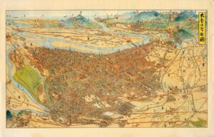
Hygiene rituals in the city of Seoul – known as Keijō during the Japanese occupation – were formally institutionalised and led by police forces bi-annually during the Japanese occupation of the peninsula in 1910 until the end of Japanese occupation in 1945.  The power over sanitation and welfare policy was transferred from the Home Ministry of Sanitation Bureau to the Police Supervisory Board in 1912.1 This article will analyse the sanitation chapter of the Annual Report on Reforms and Progress in Korea by the Government-General in 1913-14 to outline the structural failings of colonial policy and the contradictory nature of government rhetoric which promised the assimilation of Seoul’s Korean citizens into a hygienic Japanese city and simultaneously implemented a Japanese-settler-centric programme of sanitation reform.2 The Governor-General of Seoul aimed to produce clean streets and active citizens who they wanted to condition into a habit of self-regulated cleaning. This article maps the enforcement of policed hygiene standards in Seoul’s densely populated residential areas and their racially charged origins.3 Although reports by the Police Supervisory Board imply that enforcing cleaning was introduced to encourage residents to associate cleanliness with their health, this assertion assumes prior knowledge that would enable the unification of cleanliness with health.4 In contrast, Korean newspapers make it clear that the monetary cost of non-compliance and the avoidance of aggravating the police force were the factors motivating residents, not a consciousness surrounding sanitation5

Government reports consistently reflect the Japanese officials’ prioritisation of the Japanese expatriate population, who were more susceptible to illness,  despite their relatively higher wealth level and capacity to install household waste disposal and hygienic food disposal, were at the forefront of policy and the construction of service to support sanitation improvements6 The Annual Report on the Reforms and Progress in Korea in 1913-14 highlights that a series of epidemic diseases broke out on the Korean Peninsula in 1913 like cholera, typhoid fever, dysentery, diphtheria and smallpox.  Whilst the report highlights that there was a 160-person decrease in the number of deaths compared to 1912, the report is clear that there is a significantly higher number of Japanese settlers who reported epidemic cases than Koreans. For example, 1,250 Japanese caught typhoid fever and 284 died, comparatively, 700 Koreans caught typhoid fever and only 86 died of the disease.7 The report’s data emphasises that colonial policy, which enforced police-imposed standards of hygiene,  aimed to protect Japanese settlers by mobilising the Korean population, rather than establishing constructive sanitation systems that would tangibly benefit Korean citizen and align with the government’s assimilation rhetoric.8

Chart from the Annual Report on Reforms and Progress in Korea 1913-14, Epidemic diseases in Choson

Figure 1: Chart explains the number of Japanese, Korean, and foreign people with epidemic diseases and the number of people who died from those diseases. Chart from the Annual report on reforms and Progress in Korea 1913-14.9

Furthermore, the report states that to tackle these epidemic diseases “qualified Japanese physicians [will be] attached to police stations to attend to public sanitation”. The draconian method of police enforcing semi-annual cleanups was an intrusive manner through which the government restructured Korean notions of cleanliness and government reports suggest that this was done with little resistance.10 However, evasion of government officials regularly occurred due to the implementation of hospital quarantine and the enforcement of a treatment plan for Koreans once they had informed officials of their symptoms. From a cultural perspective, Koreans also deeply feared dying outside of their homes because this was a space where they believed spirits could come to venerate them after death.11  An overarching insensitivity to the social and cultural consciousness of Korean citizens curbed the efficiency of colonial policy and directly contradicted the government’s assimilation project. This can be illustrated further in the measures taken to sanitise the streets and sewage systems of Korean populated areas of Seoul.

The reports served the government by reconstructing national understandings of city management by delegitimised Korean notions of health and sanitation. In section 122, the report states that “numerous natives who only know old-fashioned Chinese methods and nothing of modern medical science”. In contrast to the government’s proliferation of Korean incompetence, the Seoul Sanitation Association (SSA), directed by the Residency-General, imposed a fee for excrement collection on the city’s Korean population when Korean fertiliser merchants were completing their task more effectively and free of charge.12 Resultantly, newspaper interviews reflect that waste was collected much less frequently, exacerbating hygiene issues whilst rural farmers suffered a resource deficit in manure.13 The SSA enforced using a top-down approach to managing sanitation which ignored the knowledge of seasoned local professionals and citizens, resultantly, many Koreans failed to pay their share due to poverty in the region and fears it was a financial fraud due to this service already being provided by local fertiliser collectors. Henry highlights that either a heavy fine or labour instead of a wage would be requested if the two sen fee was not paid.14 These policy’s did not focus on the integration of Koreans through education suited to their understandings of sanitation or the use of methods which respected the privacy of Korean people, instead, these policies ritualised cleaning and fee paying which the government felt would help to curb the infection rate of the expatriate population. Although sanitisation cooperatives and talks surrounding education on sanitation were set up partly to educate the population, their association with police enforcement significantly impacted engagement with these groups and ultimately decreased the effectiveness of lectures and other communication techniques imposed on the Korean population.

In conclusion, Henry argues that the evident subordination of Seoul’s Korean population during Japanese colonial governance is illustrative of the continual privileging of the Japanese settlers and the hegemony of the pervasion of the euro-asian power-knowledge concept into their style of colonial policy.15 Despite the Governor-Generals insistence that the aim was to assimilate the Korean peninsula into Japanese society, medical reports and municipal government data highlight that the production of knowledge regarding the causal relationship between the city’s sanitation infrastructure and the knowledge Seoul’s colonised residents had regarding sanitation was constructed to present the Japanese as superior in their understanding of health.16 Using partial knowledge of pre-established sanitation efforts used by Korean’s to ‘solve’ the city’s sanitation issues, the colonial government diagnosed the so-called “diseased city” of Keijō with issues that were only exacerbated by their presence.

  1. Todd A. Henry, Assimilating Seoul: Japanese Rule and the Politics of Public Space in Colonial Korea, (Berkley, 1972), p.137. []
  2. Governor-General of Chosen, Annual Report on Reforms and Progress in Korea by the Government-General in 1913-14, (Seoul, 1915), pp. 123 -131, Accessed at: https://archive.org/details/annualreportonreformsandprogressinchosenkorea191314/page/n171/mode/2up (Accessed on: 6/11/2023). []
  3. Henry, Assimilating Seoul, p.136. []
  4. Ibid, p.139. []
  5. Ibid.  []
  6. Ibid, p.155 []
  7. “Report on Reforms and Progress in Korea 1913-14”, Accessed at: https://archive.org/details/annualreportonreformsandprogressinchosenkorea191314/page/n171/mode/2up, (Accessed 6/10/2023), pp.125 []
  8. Henry, Assimilating Seoul, p.131. []
  9. Annual Report on Reforms and Progress in Korea 1913-14, pp.123-131. []
  10. Henry, Assimilating Seoul, p.139. []
  11. Ibid, p.142. []
  12. Ibid.p.135. []
  13. Ibid, p.136. []
  14. Ibid. p.135. []
  15. Ibid. p.139. []
  16. Ibid. []

The bedroom of Hock Gwee Thian’s house in Singapore: Inside an intricately designed Peranakan home

A unique and vibrant culture has taken root in the bustling streets of Singapore, whose members are known as Peranakans. The term ‘peranakan’ originates from the Malay word ‘anak,’ meaning child and has come to signify being locally born.1 Yet it crucial to mention the freighted task of defining the term ‘peranakan,’ for their shifting political and cultural dynamics that have come to characterise this community has led to a rich and multifaceted history. In fact, in Southeast Asia there are Peranakan Indians who are Hindu and called Chitty Melaka, as well as Peranakan Indian Muslims called Jawi Pekan, in addition to Eurasian Peranakans and Peranakan Chinese, to name a few.

However, this discussion will focus on the Chinese Peranakans in Singapore. The history of the Chinese Peranakans in Singapore traces back to the arrival of traders from the southern province of China, who settled in the Malay Archipelago. Not only did they establish a trade network, but they married local Malay women. This intermarriage gave rise to a unique blend of cultural practices, traditions and languages.2 After Sir Stamford Raffles signed a treaty in 1834 which led to the establishment of trading posts in Singapore, these traders migrated to Singapore and left an indelible mark on its architectural landscape. The shophouses, bungalows, and mansions they established in Singapore reflected the rich tapestry of cultures and traditions in which the Peranakan Chinese community engaged with throughout their history.3

Indeed, one way to explore the rich history of the Chinese Peranakan community is by taking a closer look at their homes, which also helps reflect a relationship between identity, space and architecture. The Peranakan home is a tangible symbol of the cultural fusion that defines Singapore. These homes are often built with a blend of Chinese, Malay and European architectural influences, which reflect the multicultural fabric of Singapore and the peaceful coexistence of various ethnic and cultural groups. However, there is no architectural style that can be exclusively attributed to the Peranakan Chinese, like the Peranakan people themselves, housing developed with an array of variations each reflecting a specific place, time and economic circumstance in which it was created. Therefore, this discussion will look at the memoir of William Gwee Thian Hock’s whose narration provides an illustration on how identity was forged in their living space. Yet, as one steps into the world of the Peranakan home, it is a complicated space, thus this discussion will also focus solely on the bedroom as an example of how space and identity were harmoniously woven together.


Figure 1. An extraordinary presentation of a bridal suite in a Peranakan home.4

William Gween Thian Hock’s memoir, A Nyonya Mosaic, is set in Singapore in 1910 and narrates the childhood of his Nyonya mother through her own eyes. Throughout there are scenes of happy celebrations, as well as disease and death. Hock’s scenes of a wedding are particularly intricate and colourful, and does well to shed life on the lived experiences in these homes. Moreover, figure 1 helps capture the narrative in Hock’s memoir by presenting a reconstructed Chinese Peranakan bedroom, arranged to recreate the ambiance of a wedding day for the bride and groom. Together, these two sources illustrate a contact zone where a diverse array of cultures intersect and interact.

As stated in Hock’s memoir, ‘the bridal room was on of the focal points’ and as figure 1 illustrates significant preparation and thought had gone into its spatial layout.5. Figure 1 is a striking statement to the intricate beauty that characterises a Chinese Peranakan bedroom. Within this frame, one can witness a unique cultural fusion of Chinese, Malay and European traditions blending together to create a functional space. For example, the two canopy beds display European influence, whereas its ornate carvings are quintessentially Chinese.

Hock notes ‘I was rather taken aback when few days before [the wedding] I discovered that the beautifully carved wooden ranjang loskan would bot be used for the wedding. I have always associated this bed with weddings and there were even people who knew it by the name of ranjang kahwen (wedding bed). It seemed that it was no longer fashionable to use this ornate bed, and in its place, a Victorian four-poster brass bed had been chosen … the embroidered curtain around it, the embroidered bedsheet, the embroidered pillowcases and all thh other trimmings that festooned the bed had transformed it into a most charming wedding bed.’6

Indeed, in figure 1 on closer inspection ornate wood carvings are present and are quintessentially Chinese. For example, one can locate auspicious motifs such as dragons, phoenixes, magpies and mandarin ducks which signify harmony between the marrying couple. Furthermore, another interesting aspect of this bridal suite is the carpet. These rich tapestry-like carpets are referred to as ‘Irish carpets,’ which were produced in factories owned by Scottish textile manufactures in Ireland. They are made of velvet and have a smooth finish with saturated colours. The colours are exuberant, replicating the hues of tropical flowers that are important to Chinese culture.7 This spatial arrangement highlights their diverse identity.

It is interesting to note Hock’s statement that, ‘it seems so unfortunate that a wedding so oriental in flavour should suddenly find a western touch in it just for the pride of being “modernised”‘8 Hock’s statement reflects the disappointment felt in witnessing the groom’s attire change to a western-style lounge suit. But as stated in Elizabeth LaCouture’s influential work Dwelling in the World: Family, House and Home in Tianjin China, 1860-1960, this was a symbol of modernity. For individuals living in a Chinese urban home ‘modernity was not defined through Western and Chinese temporalities and cultures. To be modern meant to be comfortable dwelling in both of these worlds.’9 This perspective is crucial as it shows how such a community navigated their identities in a changing world. Clearly, they drew from their cultural heritage while incorporating aspects of Western culture, not as a contradiction, but as a means of adapting to the complexities of modern, cosmopolitan life.

This brief exploration of a traditional Peranakan wedding and the Peranakan bedroom effectively highlights how this community accepted, adopted and assimilated diverse cultures to form a cosmopolitan community of their own, based on their understanding of the world and conceptions of the modern.

  1. David HJ Neo, Sheau-Shi Ngo, Jenny Gek Koon Heng, ‘Popular imaginary and cultural constructions of the Nonya in Peranakan Chinese culture of the Straits Settlements,’ Ethnicities, 20:1 (2020), p.25. []
  2. Patricia Ann Hardwick, ‘”Neither Fish nor Fowl”: Constructing Peranakan Identity in Colonial and Post-colonial Singapore,’ Folklore Forum, 38:1 (2008), p. 37. []
  3. Roland G., Knapp, Peranakan Chinese home: Art and culture in daily life (2017), p.6. []
  4. Figure 1, ‘Image of a reconstructed Peranakan bridal suite,’ in Roland G., Knapp, Peranakan Chinese home: Art and culture in daily life (2017), p.142. []
  5. William Gwee Thian Hock, A Nyonya Mosaic: Memoirs of a Peranakan Childhood, (2013), p. 76. []
  6.   Hock, A Nyonya Mosaic, p. 78. []
  7. Knapp, Peranakan Chinese home, p.144.  []
  8. Hock, A Nyonya Mosaic, p. 104. []
  9. Elizabeth LaCouture, Dwelling in the World: Family, House and Home in Tianjin China, 1860-1960, (New York, 2021), p. 153. []

Hill Stations of Indochina: A retreat from tropicality.

[Hill Stations] are areas where French can live, work and firmly establish our race. Indigenous peoples are currently sparse enough to avoid having to evict anyone. Should all these high-altitude regions be populated by settlers, farmers, planters, and French breeders- as is possible and as it must be- and civilization in Indochina, the sovereignty of France in this part of the Far East will be establish indestructibly.1

This passage in Paul Doumer’s Situation de I’Indo-Chine articulates the prevailing view held by French colonisers during the conquest of Indochina. When the French arrived in Indochina, they were confronted with a climate that starkly contrasted with their homeland in Europe. The tropical climate was characterised by its high temperature, oppressive humidity, and a range of diseases that were largely unfamiliar to settlers. Although French adventures, settlers and soldiers, were captivated by Indochina’s beauty, many of them struggled to love in the region comfortably. The French and prominent Dr. Le Dantec stated that ‘the negative influence exerted over time by tropical climates on the health of Europeans… has been and remains the most serious obstacle to our colonisation efforts. This quote underscores the gravity of the situation where health quickly became the foremost concern of French colonisers.

The need to combat the adverse effects of the tropical climate spurred architectural and spatial transformations. The French introduced a new concept of territory and environment – the hill stations. The most notable example is Dalat, which aimed to recreate an approximation of their home environment and climate, and provide a respite from the harsh tropical lowlands. Hill stations had no equivalent in Indochina; their creation was ex nihilo2 Everything had to be decided, designed and built. This developed a new conception of the way that territories could be inhabited, more significantly where the French could ‘firmly establish [their] race.’ This phrase is crucial echoing Social Darwinism and its notions of racial inequality and racial competition, and the ideological motivations behind the creation of this space. Furthermore, the creation of such a space was not just a response to the tropical climate as it represented a deliberate effort to create a space where the French could exert their power. by demonstrating their ability to conquer the tropical environment, the French clearly believed that they could justify their presence in Indochina.

In general, these elevated retreats challenge conventional understanding of ‘tropicality.’ The well-renowned geographer and anthropologist Pierre Gourou emphasised the need to recognise diversity and move beyond simplified definitions of tropicality. The space of hill stations such as Dalat challenge the conventional notions of tropicality, forcing a reconsideration of the region’s climate as more than uniformly hot and humid. Hill stations introduce the idea of microclimates within tropical regions, where altitude could mitigate the intensity of the heat. Furthermore, in this particular context of the development of Dalat, it provides a useful lens through which spatial history can be explored. The work of Eric Jenning’s is the foundational premise of this discussion, for Jennings’s work was the first to uncover the importance of Dalat.

Dalat lies in the heart of Vietnam’s central highlands and has an unique history. Dalat was designed to be a sanctuary from the tropical rigours of Indochina. Its cooler climate, nestled amid pine forests and rolling hills, provided not only a physical respite but also a mental escape from the conventional definitions of tropicality.3 The bacteriologist Alexandre Yesin, protégé of the renowned French chemist Louis Pasteir, peitioned the French governor-general, Paul Doumer, to create a resort centre in the highlands. By 1907, Da Lat had been selected as the location for such a town so started urban planning under the leadership pf Ernst Hebrard. A French journalist described the result:

[In Dalat] French determination has created an elegant and harmonious town, developed in such a way that it has become a veritable little paradise, in a setting of flowered gardens and pine trees… In designing the town, we avoided pretentious and unattractive buildings. Everywhere, delectable villas hide behind lovely gardens, gardens full of flowers from Europe. Roads are wide, asphalted, and offering breathing room. On the vast artificial lake’s limpid waters, majestic swans swim by. Tennis courts and a perfectly conceived gold course add a sporting note to the resort.4.

Through the use of extensive hyperbole one is able to detect the cultural superiority that the French wished to emit in their mission to create a utopia.  A ‘little paradise’ that would be entirely French in its vegetation, aesthetics and its amenities. But as Eric Jenning’s insists Dalat is a ‘singular, unexpected, almost incoherent place,’ as on the one hand it was an articulation of power but on the other it is a place that showcases colonial anxiety and the limitations of the french in adapting to the tropicality.5 This helps to provide a wealth of knowledge that advances and challenges pre-existing notions.

Firstly, in the European perceptions of tropical climates, there often emerged vivid descriptions of disease-ridden discomfort and extreme weather conditions. While there’s a measure of truth in these descriptions, it is particularly intriguing to examine the construction of the Xuan Huong Lake in Dalat. In its construction the lake was intended to serve as an oasis of comfort, designed to offer a stark contrast to the challenging tropical conditions and provide an idyllic setting for relaxation and recreation. Ironically, this man-made lake at the centre of the town, together with increased migration from surrounding areas with endemic malaria, resulted in bringing mosquitoes and humans together.6 Malaria was a grave menace to the French rule in Indochina. This unintended consequences underscores the limited understanding of the complexities of the tropical environment by the French authorities. Their focus on creating comfortable and European-style spaces in the midst of tropical challenges led to unforeseen health risks.

Second is the tension between the preservation of identity, and cultural hybridity. Notions of tropicality stress colonial exclusivity, but Dalat became witness to the proliferation of Vietnamese interactions which significantly altered its spatial history. Despite their best efforts to create a French Dalat utopia where ‘delectable villas hid behind lovley gardens, gardens full of flowers from Europe,’ the very act of colonisation ensured that the local culture and people would play a significant role in shaping the city. Vietnamese labourers, both on plantations and in the construction of railways, were essential for making the French vision reality, and their labour left an indelible mark on Dalat’s cultural landscape. Moreover, the presence of Vietnamese elites and the middle class for vacationing and leisure further eroded the French colonial vision of exclusivity. Not only did these interactions influence the city’s demographics, but they also created a unique cultural hybridity. This can be observed in the monuments and temples constructed in Dalat, including the Thein Vuong Co Sat Pragoda and the Truc Lam Buddhist temple. 7 The attempts to create utopia that would preserve French identity, also contributed to a place that showcased cultural hybridity, transcending the boundaries of a purely French enclave.

The very act of attempting to ‘establish their’ race in Dalat led to a situtaion where the city became a contradiction to preserved notions of tropicality, Instead of a purely European, exotic, and unchanging landscape, Dalate became a dynamic and culturally diverse place that challenged the colonial agenda. Indeed, by studying a particular place in time, one is able to gained a much comprehensive understanding of the concept of tropicality in all its complexities.

  1. Paul Doumer, Situation de I’Indo-Chine. 1897-1901, cited in Aline Demay, Tourism and Colonisation in Indochina 1898,1939, p.49 []
  2. Aline Demay, Tourism and Colonisation in Indochina 1898,1939, p. 47. []
  3. Eric T.  Jennings, Dalat and the making and undoing of French Indochina, p. 1 []
  4. ‘A French Journalist for L’Asie nouvelle,’ in Eric T.  Jennings ‘Urban Planning, Architecture, and Zoning At Dalat, Indochina, 1900-1944, Historical Reflections, 33:2 (2007), p327 []
  5. Eric T. Jennings,  Dalat and the making and undoing of French Indochina, p.4 []
  6. Michitake Aso, ‘Patriotic hygiene:Tracing new places of knowledge production about malaria in Vietnam, 1919-75,’ Journal of Southeast Asian Studies, 44:4 (2013), p.433. []
  7. Eric T. Jennings,  Dalat and the making and undoing of French Indochina, p.  171- 172. []

The Newspaper Excerpts, HEALTH IN THE TROPICS: the tropic disease and the racial discrimination

Figure 1. The excerpts of newspaper

The study of the tropics was prevalent throughout the previous century when imperial colonisation was still dominant around the globe. Against this backdrop, an article from a local Singaporean newspaper The Straits Echo, titled “Health in the Tropics”, published on 6 February 1914, became the focus of this blog. Focused on the well-being of Europeans residing in the tropics, the article claims that “while the white man individually can exist in the tropics, racially he cannot persist Acclimatisation is not possible.”1 This perspective inherently suggested that the white race and the tropics were mutually exclusive, proposing an inability for integration. Drawing from the insights of the article, the blog contends that the broad study of the tropics of the time was inherently a study of racial distinctions. Given this context, the emergence of the study of tropics served as a vehicle for manifesting and solidifying racial differentiations within these landscapes.

The opening statement of the newspaper article posits that, “Man is the creature of his environment; he is what he is by virtue of his surroundings.”2 It shows the author’s firm belief in the intimate correlation between the environment and the creation, formation, and perpetuation of the human race. The author proceeded to highlight what the Europeans perceived as the most substantial detriment inflicted upon the white race by the tropics – the direct impact on “the function of the nervous system.”3 The author gave many examples to clarify the concrete harm. For example, in India, “The Duke of Wellington never met a good-tempered Englishman.”3 In addition, “it has been written in India that there the European struggles during the first, dwindles and degenerates during the second, and becomes extinct as such, during the third or fourth generation.”4 Such a description of the offspring of the white race bred in the tropics made the incompatibility between the white race and the tropics more tangible. It indicated that particular regions breed distinct racial identities, suggesting that Europeans acclimated to such settings would inevitably succumb to a deteriorating state, transforming into an ailing race. The author’s narrative starkly presented these two entities as entirely mutually exclusive. The prolonged residence of whites in the tropics would result in the erosion of their inherent racial characteristics. The tropical environment, as per the author’s depiction, emerged as a significant threat perilously jeopardizing the continuity of the white race.

This exploration of the incompatibility of the white race with the tropics essentially embodies the European expression of racial distinction. This expression was not limited in Singapore. Similar expressions surfaced in other colonial territories like the French colony of Hanoi in Vietnam and the Dutch colony of Jakarta in Indonesia. In Singapore, Europeans emphasised the eternal damage to the white nervous system caused by the environment of the tropics. In Hanoi, the French colonial government of the time published the French guides on hygiene, which “attempted to systematize and rationalize architecture through the lens of science … (to) reduce the discomfort of living in tropical climates.”5 In Jakarta, “European residents repeatedly tried to escape the ziektenhaard (breeding ground for disease) by continually moving southwards away from the northern old city,”6 and “racialized the previous class based divisions between urban spaces and urban populations,”7 which led directly to the Jakarta’s fragmented modern water supply system. These instances collectively illustrate the European perception of the incongruity between the tropics and the white race. The Europeans intended in their colonies to separate the local populations from the Western settlers, establishing communities that mirrored societal conditions from their home countries. In Singapore, the studies of tropic disease cautioned the white race against prolonged stays in the tropics for a long time. In Hanoi, the white race was required to ensure its safety and purity while differentiating itself from the local race by following the guidelines published by the Europeans. In Jakarta, white people prioritised their water supply needs and built modern water supply systems for their ethnicity.

These examples demonstrate the European’s effort to delineate racial distinctions. The endeavor was driven by the singular aim of safeguarding European own race and ensuring its sustained existence in tropical territories. Whether manifested through a newspaper article with a study highlighting potential harm for Europeans in tropical climates, the publication of French hygiene guidelines in Hanoi, or the establishment of a new water supply system in Jakarta, the primary objective essentially centred on differentiating races of that era. These initiatives were primarily geared toward securing the continuation of European livelihoods rather than conducting comprehensive, inclusive studies encompassing the broader spectrum of racial experiences within these contexts.

  1. ‘Health in the Tropics’, The Straits Echo, Singapore, 2 February 1914, p. 141 https://eresources.nlb.gov.sg/newspapers/digitised/article/straitsechomail19140206-1.2.27?qt=tropic,%20hygiene&q=tropic%20hygiene [accessed 29 October 2023]. []
  2. ‘Health in the Tropics’, p. 141. []
  3. Ibid. [] []
  4. Ibid. []
  5. Laura Victoir and Victor Zatsepine, Harbin to Hanoi: The Colonial Built Environment in Asia, 1840 to 1940 (Hongkong, 2013), p. 234. []
  6. Freek Colombijn and Joost Coté, Cars, Conduits, and Kampongs: The Modernization of the Indonesian City, 1920-1960 (2014), p.66. []
  7. Colombijn and Coté, Cars, Conduits, and Kampongs, p.68. []

Lap Sap Chung and the cleanup of Hong Kong in the 1970s

Hong Kong today is seen as a modern metropolis with an efficient transport system, high-quality healthcare and high awareness of personal hygiene. Growing up in Hong Kong, I was taught as early as kindergarten to wash my hands with soap after taking a dump, recycle certain items in specific bins and most importantly not litter as it would attract bugs and rats. Additionally, in various public spaces like metro stations, wet markets and railings, there are ubiquitous colourful signs informing the population to not litter or spit on the streets, threatening them with a high fine.1 From a young age, I asked my parents why Hong Kong is so obsessed with hygiene and cleanliness, and my parents told me without hygiene education, Hong Kong would not be Hong Kong today. They told me that during their childhood they had to undergo hygiene education at school and constantly saw hygiene commercials and leaflets that warned them against unsanitary habits like spitting, blowing their nose in public, not washing vegetables, eating raw meat, and urinating in public. This signifies that hygiene in modern Hong Kong, unlike the notions of hygiene used to weaponise or justify imperialism like the case of the Japanese blaming Koreans in Keijo2, the British Hong Kong government starting in the late 60s devolved powers to locally-educated individuals to educate the lower classes through indirect means which is the main focus of this blog. To illustrate my point, I will be focusing on a newspaper report regarding hygiene from the Wah Kiu Yat Po published in 1972.

Figure 1: Lap Sap Chung poster in the Clean Up Hong Kong campaign, extracted from: https://zolimacitymag.com/lap-sap-chung-monster-kept-hong-kong-clean-ah-tak/

Above is the illustration of Lap Sap Chung which translates to rubbish bug which is a fictional character created by cartoonist Arthur Hacker.3 Lap Sap Chung was created as a method to appeal to Hong Kong residents because its unsanitary behaviour included littering and dirtying the streets, which was a massive problem in Hong Kong that led to diseases and deaths. By having a figure to ostracise those bad behaviour, it gives the incentive for Hong Kong people to work hard to clean up their city and foster a sense of identity to showcase what being ‘civilised’ and ‘modern’ is like. Unlike the colonial mentality of sanitation as per the readings, the campaign does not directly imply that the local Hong Kongers are dirty compared to their British overlords but rather it is everybody’s collective effort to maintain a clean Hong Kong. It is in reflection of the changing attitude towards governance as after the 1967 riots, the British colonial government realised that in order to prevent the spread of communism’s appeal and discontent among Hong Kong residents, improving livelihoods through education and concerted efforts are crucial to ensuring it.4

Drawing from the Wah Kiu Yat Po’s newspaper report on 9th September 1972, it showcases a headline in which residents caught violating the laws of public hygiene will be fined HKD$1000 and the second offence increasing to HKD$2000, somewhere around the sum of nearly a thousand pounds in today’s money.5 Although hefty fines were proven to be ineffective as in the case of Korea under Japanese rule and Singapore under the British colonial government, the main difference that differs Hong Kong’s case than the other two cases is the use of the Lap Sap Chung. As the article says, the board director of the ‘Clean Hong Kong Campaign’ was headed by a local, Wong Mong Fa, who quotes that the first step of advertising the campaign is declared a success and that the second step involves education. In order to succeed, the use of inspection teams to inspect every apartment block and verbally educate the residents about the laws regarding sanitation. In addition to the teams, leaflets, radio broadcasts, commercials, and newspapers will also be utilised to complement the efforts of the inspection teams. This showcases that the British colonial government was different from their attitudes towards Singapore in6 where the locals and British colonial officials were pitted against one another in the late 1930s, the 1970s in Hong Kong showcased how getting the locals to cooperate through increasing local involvement is actually a much better solution as educating the lower classes and ensuring citizens understood the laws thoroughly. This demonstrates how the involvement of different factors is needed in order to increase education and awareness about a hygienic society.

In conclusion, the example of Lap Sap Chung is widely regarded as a success as Hong Kong’s previously dirty streets have witnessed a massive improvement, and kids of individuals who grew up under the ‘Clean Hong Kong’ campaign like myself have seen the long-term effects of effective hygiene education not through just school but through digital and print media. Local involvement and the absence of racial ostracisation is what drive public health campaigns forward.


  1. Steve Tsang, A Modern History of Hong Kong, 2003 []
  2. Todd. A Henry, Assimilating Seoul: Japanese Rule and the Politics of Public Space in Colonial Korea, 1910-1945 Ch 4 Civic Assimilation: Sanitary Life in Neighbourhood Keijo []
  3. https://zolimacitymag.com/lap-sap-chung-monster-kept-hong-kong-clean-ah-tak/ []
  4. Steve Tsang, A Modern History of Hong Kong 2003 []
  5.  https://mmis.hkpl.gov.hk/search-result?p_p_id=search_WAR_mmisportalportlet&p_p_lifecycle=0&p_p_state=normal&_search_WAR_mmisportalportlet_keywords=%E8%A1%9B%E7%94%9F&_search_WAR_mmisportalportlet_hsf=%E8%A1%9B%E7%94%9F&_search_WAR_mmisportalportlet__cnsc1002_WAR_mmisportalportlet_formDate=1698495896489&p_r_p_-1078056564_actual_q=%28%20verbatim_dc.collection%3A%28%22Old%5C%20HK%5C%20Newspapers%22%29%20%29%20AND+%28%20%28%20allTermsMandatory%3A%28true%29%20OR+all_dc.title%3A%28%E8%A1%9B%E7%94%9F%29%20OR+all_dc.creator%3A%28%E8%A1%9B%E7%94%9F%29%20OR+all_dc.contributor%3A%28%E8%A1%9B%E7%94%9F%29%20OR+all_dc.subject%3A%28%E8%A1%9B%E7%94%9F%29%20OR+fulltext%3A%28%E8%A1%9B%E7%94%9F%29%20OR+all_dc.description%3A%28%E8%A1%9B%E7%94%9F%29%20%29%20%29&p_r_p_-1078056564_new_search=true&p_r_p_-1078056564_q=%E8%A1%9B%E7%94%9F&p_r_p_-1078056564_freetext_filter=%E6%88%BF%E5%B1%8B&p_r_p_-1078056564_freetext_filter=%E7%97%85%E6%AF%92&p_r_p_-1078056564_curr_page=1&_search_WAR_mmisportalportlet_jspPage=%2Fjsp%2Fsearch%2Fcnsc05.jsp []
  6. Yeoh, Brenda, Contesting Space in Colonial Singapore Ch 3 Municipal Sanitary Surveillance, Asian Resistance []

Building on Tradition: From Kampong to High-Rise, the ‘tropical city’ and its manifestation in Singapore

The elusive topic of tropicality has pervaded conversations surrounding the design and function of Singaporean architecture since the imposition of Western architectural styles and layouts following the ratification of the Treaty of Singapore in 1819. This article will argue that the categorisation of Singapore as a ‘tropical city’ comprised of ‘tropical architecture’ is the product of colonial power that was integrated into the production of knowledge about the built environment and is therefore inherently responsible for the continuation of discourses that associate Southeast East cities as the ‘other’ to those in Western, temperate climates.1 However, as architects like Mr Tay Kheng Soon illustrate the term ‘tropical city’ has also served as a reclamation of Singaporean independence and the celebration of the city’s culture and agency through a selective incorporation of European modernity.2 This article analyses a Straits Times interview conducted in 1989 by Patrick Daniel and Caroline Chan of the Singaporean architect Mr Tay Kheng Soon who applied his vision of the tropical city to Singapore to detach the independent city-state from the epistemic conquest of British hegemony.3

Figure 1: Article in The Straits Times, “Concept for future city: Living in a work of art”.4

Tay envisioned an “intelligent tropical city” and argued that a tropical city could emancipate Singaporeans from the economic dominance of Britain in the region.5 He aimed to re-politicise urban planning by separating the city from the “mono-cultural compactness” of colonial offices and housing by designing Singapore to be a “work of art” and a compact city capable of “increasing business opportunities” and “providing a medium for intense, social, cultural and economic exchange.6 By using the tropical city concept, Tay identifies that the architectural aesthetics of tropicality were attached to colonial and post-colonial power relations and seeks to separate Singapore from these streams of power. By designing a city which prioritises “poly-cultural compactness”  to form a  “support structure for their [people’s] activities… and yet contribute to the cooling of the city as a whole” he illustrated that colonial power was ingrained in the construction of Tropicality. Equally, he highlights that Signporean architects had the necessary tools to begin deconstructing this discourse.7

The introduction of ‘tropical architecture’ established a sphere of knowledge which ran through Imperial networks during the colonisation of Singapore and was utilised by the Colonial Office to ‘other’ Southeast Asian architecture in opposition to temperate architecture.8 The term tropical architecture prioritises the climate in its terminology whereas temperate architecture is categorised by regional geographic zones or nations, imposing a homogenous staticity onto Singaporean urban development.9 Tropicalisation involved the surface-level modification of Western governmentalities to tropical conditions rather than the necessary transformation.10 Tay emphasises that in the 1980s tropicality was not considered “another symbol of modernity” and he asserted that the “big bland blocks” of highrises that covered the city were “still a sign of the captive mind”.11 Indeed, the “captive mind” he refers to in the Straits Times interview illustrates the power-knowledge concept and the overt control colonial powers had over conceptions of tropical architecture and their subsequent limitation of the built environment to benefit colonial wealth and power.12  The perpetuation of this reductive understanding of the city’s needs justified the colonial administration’s choice to prioritise Singapore’s sanitation and fears of reassuring contamination issues, rather than holistically solving civic issues through the optimisation of the built environment.13

Tay’s Straits Times interview and his successive proposals for tropical urbanism began to combat the circulation of British colonial networks and their epistemic conquest over the focal point of Singapore’s housing strategies by proposing socio-economic structural problems were addressed which would in turn resolve sanitation issues.14 By proposing that the tropical city is defined by its interconnectedness, Tay defined the tropical city by its, “combination of tropical rain forest with the city by increasing transpiration”.15 To establish Singaporean independence from colonial power relations Tay designed a climate-responsive built environment, working in favour of its citizens.16 His holistic approach to the city and its economy assimilated tropical architecture into the tropical climate rather than adopting temperate architectural models that exacerbate the urban heat island effect.17 As Chang explains, the architectural aesthetics of tropicality are inseparably bound to colonial and postcolonial power relations and the implementation of Western hegemony through ideals of social order and the application of policy.18 These concepts are closely linked to the sanitisation movement and the colonial government’s preoccupation with contamination, these fears greatly influenced the structure and organisation of Singapore’s housing and the developments that occurred beyond the European socio-spatial enclaves of the city.19

Tay’s reclamation of the term ‘tropical city’ reflects the complex relationship between language and the built environment in Singapore’s postcolonial legacy. Alongside other regional architects, Tay produced a deviating discourse on tropical architecture that challenged the cultural and economic supremacy of the West by proposing a multi-tiered city. By prioritising the city’s functionality, his urban planning methods and vision were ahead of their time and later were used to distinguish Singaporean identity as heterogonous and separate from Western notions of tropicality.

  1. Chang Jiat-Hwee, A Geneology of Tropical Architecture: Colonial Networks, Nature and Technoscience (New York, 2016), p.7. []
  2. Chang, A Geneology of Tropical Architecture, p.1. []
  3. Chang Jiat-Hwee, “Deviating Discourse: Tay Keng Soon and the Architecture of Postcolonial Development in Tropical Asia”, The Journal of Architectural Education, 63:2 (2010): 153. []
  4.  Kheng Soon Tay, “Concept for the future city: Living in a work of art”, The Straits Times, Singapore, 8th May 1989, p.16 Accessed at: https://eresources.nlb.gov.sg/newspapers/digitised/article/straitstimes19890508-1.2.49.2 (Accessed 24/10/2023) []
  5.  Kheng Soon, “Concept for the future city: Living in a work of art”. []
  6. Ibid. []
  7. Ibid. []
  8. Chang, A Geneology of Tropical Architecture, p.5 []
  9. Ibid, p.6 []
  10. Chang Jiat-Kwee, “Tropicalizing Planning, Sanitation, Housing and Technologies of Improvement in Colonial Singapore, 1907-1942”, in Robert Pecham and David Pomfret (eds.) Imperial Contagions: Medicine, Hygiene and Cultures of Planning in Asia, ( Hong Kong, 2013), p.41. []
  11. Kheng Soon, “Concept for the future city: living in a work of art”.  []
  12. Chang, A Geneology of Tropical Architecture, p.6. []
  13. Chang, “Tropicalizing Planning, Sanitation, Housing and Technologies”, p.37. []
  14. Chang, “Deviating Discourse”: 154. []
  15. Kheng Soon, “Concept for the future city: living in a work of art”. []
  16. Ibid. []
  17. Chang, “Deviating Discourse”: 157. []
  18. Chang, A Geneology of Tropical Architecture, p.2. []
  19. Chang, “Tropicalizing Planning, Sanitation, Housing and Technologies”, p.38. []

The excerpts of An Account of the Kingdom of Cabul – the early 19th European perspectives towards the oriental world: a big cabinet of curiosities

When discussing the ideology of Orientalism, one would naturally refer to Edward Said’s explanation of Orientalism proposed in 1978, that is, “the East as its (the West’s) inferior and essentialized ‘other’.”1 Felix Driver similarly claims that in the 18th and 19th centuries, the Europeans considered the oriental world a chaotic place. They should make it an orderly place in the name of enlightenment.2 [2] Both arguments highlight the European perceptions of the inherent inferiority of the oriental world. Nevertheless, this blog will offer an alternative perspective prevalent in the early 19th century and argue that, instead of casting the oriental world into an inferior position, the Europeans viewed it as an undiscovered place – a big cabinet of curiosities that was neutrally observed. Specifically, the Europeans’ perceptions were inconsistent, lacking a unified idea towards the Orient and its inhabitants. The Europeans maintained a neutral attitude towards the oriental world. This big cabinet of curiosities stimulated a sense of novelty and diversity contrary to Driver’s description – a sense of salvation. The blog draws upon excerpts from An Account of the Kingdom of Cabul as examples to illustrate these assertions.

Published in 1815, An Account of the Kingdom of Cabul was finished by Mountstuart Elphinstone, a Scottish diplomat and colonial administrator.3 The book chronicled his journey into the oriental land, which has many of the cultural and topographical hallmarks of “the Orient.”4 His narratives on one of the book’s chapters – Book II, Chapter I: General Account of The Inhabitants of Afghaunistaun highlighted the oriental world’s diverse and multifaceted nature in the early 19th century, rather than perceiving the oriental land as homogenous. The author’s observation of the diversity of the orient world led to a neutral attitude, avoiding the denigrating view often associated with Europeans of that era.

Elphinstone’s portrayal of the oriental world in his book resembled a vast cabinet of curiosities teeming with novelties distinct from Europe. According to David Arnold, Elphinstone introduced the elements such as camels, oases, mirages, date palms, the “Jewish” countenance of girls, which invoked many typical oriental images that established for later writers a rich repertoire of Oriental scenes and emblems.5 Furthermore, he offered unique geographical views on the oriental land. He noted, “he would be amazed at the wide and unfrequented deserts, and the mountains, covered with perennial snow.”6 These novelties had established the foundation of the cabinet of curiosities because they were numerous and surprising. What stands out remarkably was the lack of homogeneity within the oriental realm itself. Elphinstone’s comparative analysis between different parts of the Afghaun land and between the Afghaun land and India were great presentations. In the Afghaun land, he found “it difficult to select those great features, which all possess in common, and which give a marked national character to the whole of the Afghauns.”7 Moveover, in India, he highlighted “every movement originates in the government or its agents, and where the people absolutely go for nothing,” while in the Afghaun, “the control of the government is scarcely felt, and where every man appears to pursue his own inclinations, undirected and unrestrained.”8 Apparently, even within the oriental landscape, a unified set of characteristics remained elusive.

The rich tapestry of novelties and diverse elements within the oriental world contributed significantly to the construction of the cabinet, shaping Elphinstone’s impartial understanding of this intriguing sphere. When discussing the characteristics of the Afghaun, he adeptly balanced admiration for their strengths with an honest acknowledgment of their weaknesses. Positively, he noted, “he would scarce fail to admire their martial and lofty spirit, their hospitality”,9 and “he would admire their strong and active forms, their independence and energy of their character.”10 Negatively, he mentioned, “he would find it difficult to comprehend how a nation could subsist in such disorder; and would pity whose minds were trained by their unhappy situation to fraud and violence, to rapine, deceit, and revenge.”9 Instead of adopting a one-sided stance of praise or denigration, Elphinstone viewed their characteristics through a nuanced lens, offering a balanced narrative. This neutral discourse blended with emotional empathy and rational assessment, created an organic cabinet of curiosities.

Overall, the blog intends to present a view different from the contemporary interpretations of the European understanding of the oriental world. Instead of considering the Orient as the weak, the early 19th-century traveller Mountstuart Elphinstone constructed a big oriental cabinet of curiosities. He showcased the distinguishable landscapes of the oriental land, highlighted the internal variations of this land, and expressed the neutral discourse instead of forming a stereotype of degrading the Orient. The big oriental cabinet of curiosities was therefore established by the land’s novelty and diversity, and the rational assessment of Elphinstone.

  1. David Arnold, The Tropics and Travelling Gaze (2006), p. 119. []
  2. Felix Driver, “Imagining the Tropics: Views and Visions of the Tropical World,” Singapore Journal of Tropical Geography, 25: no. 1 (2004), p. 14. []
  3. Arnold, The Tropics and Travelling Gaze, p. 122. []
  4. Ibid., p. 123. []
  5. Ibid. []
  6. Mountstuart Elphinstone, Account of the Kingdom of Cabul (1815), p. 149. []
  7. Elphinstone, Account of the Kingdom of Cabul, p. 148. []
  8. Elphinstone, Account of the Kingdom of Cabul, p. 150. []
  9. Ibid., p. 149. [] []
  10. Ibid., p. 150. []

Frans Post: Painting Tropics for a European Market

Frans Post, a 17th century Dutch painter, travelled to Brazil in 1636 as a part of the colonial Governor’s entourage. His mission was to visually record the fauna, flora, and environment of Brazil.1 He returned to the Netherlands in 1644, having only completed 6 paintings. The majority of his work came afterwards, as he produced over a hundred more paintings of Brazil throughout the rest of his career. However, as Stepan notes, the character of his post-Brazil work differs greatly from the work produced while living there.2 By comparing works from each period, we can see the construction of an imaginary tropics in action.

The Old Portuguese Forte dos Reis Magos, or Fort Ceulen, at the Mouth of the Rio Grande, by Frans Post 1638

The Rio São Francisco and Fort Maurits, with a Capybara in the Foreground, by Frans Post 1639

Both produced during his time in Brazil, these two paintings share characteristics common to Post’s early work. Firstly they share a muted colour palette, both dominated by a grey, cloudy sky. The water which is featured prominently in both paintings is similarly coloured. Secondly, they focus on identifiable, real locations. The presence of forts and identifiable physical features lends these paintings a sense of grounded reality. There is little of what David Arnold would call “tropicality”, the construction of the tropics in the western mind as an “other” based on depictions in literature and art, as there is no juxtaposition with “normal” temperate lands.3 Here, Brazil is represented not dissimilarly to how contemporary landscapes of Europe would be. Post’s early paintings appear to honestly depict the landscape and life of colonial Brazil, fulfilling his mission in the New World.

The Home of a “Labrador” in Brazil, by Frans Post 1650-55

Brazilian landscape with anteater, by Frans Post 1649

Considering these works painted after Post arrived back in Europe, a shift in tone is obvious. The sky is no longer oppressive and grey, but blue and expansive. This feeling of space is also aided by situating the viewpoint high up as to reveal the landscape sprawling before the viewer. In addition, the locality of the paintings becomes more ambiguous. Post’s post- Brazil work almost unanimously depicts generic scenes of Brazil, rather than real locations. A third noticeable difference is the increase of flora in the painting foregrounds, as palms and ferns replace the waterways which took precedent in Post’s earlier work. “Tropicality” had clearly taken a toll on the authenticity of Post’s work, as values commonly associated by with the tropics by the seventeenth century European masses seep into the artwork and take on an exaggerated form.

The clear, blue skies firstly evoke sun and heat, characteristics which had been linked to the tropics since Hippocrates.4 The real Brazil has a number of different biomes and climates which are not represented by Post, who instead chooses to essentialize Brazilian weather to conform with commonly held perceptions. In conjunction with the sprawling landscapes, however, the paintings gain a double meaning, as they emphasize the openness of the tropical world. In the seventeenth century mind therefore, the tropics took on a promise  of adventure and reward, with wide horizons of endless opportunity. The depiction of endless empty land can be argued to be an invitation for conquest of it, or the claiming of a monetary or political fortune. The tropics can thus be seen to have had an allure of potentiality in Post’s time.

The greater presence of foliage in the latter paintings speaks to the expectations of fertility and abundance in the tropics. Dense underbrush and towering megafauna were clearly already quintessential images associated with tropical landscapes. Compared to the restrained representations of foliage in The Rio São Francisco and Fort Maurits, with a Capybara in the Foreground, these examples seem to over exaggerate the presence of plants in the Brazilian landscape, playing to these expectation of fertility rather than honestly depicting floral specimens. There is also a reliance on the image of the palm tree, which had become an icon of the tropics, over any other type of flora across Post’s later work. He had clearly departed from his original aim of accurately capturing Brazilian life, and sought instead to create landscapes which were expected of Brazil. Alongside the new focus on non-specific scenes of Brazil, this can be taken as evidence of Post’s new commitment to an imaginary Brazil.

It is unclear whether the stark differences in Post’s paintings from his stay in Brazil and after should be attributed to the market for which he was painting, the effects of popular tropical conceptions on his own memories of Brazil, or a combination of factors. Regardless, a comparison between these two periods of his work clearly demonstrates the work of popular discourse and imagining on representations of the tropics in seventeenth century Europe.

  1. Frans Post (about 1612 – 1680) | National Gallery, London []
  2. Nancy Leys Stepan, Picturing Tropical Nature (London, 2001), p. 19. []
  3. David Arnold, The Tropics and the Traveling Gaze: India, Landscape, and Science, 1800-1856 (Seattle, 2006) []
  4. Hippocrates,  Airs, Waters, Places []

Exhibiting Modernity and Colonisation: What Yoshida Hatsusaburo’s map of the 1935 Taiwan Exhibition indicates about Taiwan and Japanese Imperialism.


Fig 1. ‘The 1935 Taiwan Exposition: In Commemoration of the First 40 Years of Colonial Rule’, Source: ‘Special Exhibition: Back in their times: a visual history of Taiwan from the 1930s to the 1960s’,  The 228 Memorial Foundation, accessed 9th of October 2023, Special Exhibition|Back in their times: a visual history of Taiwan from the 1930s to the 1960s|Memorial Foundation of 228.National 228 Memorial Museum

This map by famed aerial artist Hatsusaburō Yoshida of ‘The 1935 Taiwan Exposition: In Commemoration of the First 40 Years of Colonial Rule’ is representative of Japan’s desire to project their ideas of utopian modernism to the rest of the world and to mainland Japan. Their rational of modernising to protect themselves from, and surpass western empires is somewhat undercut by the fact that their concept of the modern were inherently modelled, at least spatially speaking, from said international influences. 

The map itself is keeping with a trend of colonial mapmaking that emerged in the 1930s which combines Japanese pictorialism with new photographic technology, specifically aerial photos. This genre of maps have been classified as Chōkanzu and were notable for their bird’s eye view perspective, 3 dimensional representation, colourful design and most importantly, picturesque quality (1). Looking at maps with this style it becomes quickly apparent that the intended audience for the map was not the urban planner, engineer or government official but the tourist.  As Allen asserts, it gives the localities it depicts a ‘postcard destination’ quality (2).

Below is another example of Taipei represented in this style on the eve of the 1935 Taiwan Exposition.


 Fig 2. ‘Bird’s Eye Map of Greater Taipei’,  Source: Keoni Everington, ”Colorful ‘Bird’s Eye View of Taipei” Japanese map circa 1935,  Taiwan News, (13th of January, 2017), Colorful ‘Bird’s Eye View of Taipei” Japanese map circa 1935 | Taiwan News | 2017-01-13 18:30:00

Between them there are distinctive similarities: the detailed architecture, the scroll labelling and iconography of both transport and industry, and of leisurely parks and nature. They both simultaneously portray an image of a cosmopolitan and prosperous nation, and a luxurious and leisurely travel destination. They exist as publicly accessible texts that visualise the city in modern and idealistic terms. While they exist as Japanese colonial propaganda, they do so in different ways. The ‘Bird’s Eye Map of Greater Taipei’ on its own encapsulates Japanese colonial ideology by its foregrounding of Japanese settlements over Chinese areas, and the fictious geographic placing over the water of Japan’s iconic Mount Fuji and other colonies – Korea and Manchukuo. As Allen asserts, this representation is one of possession and desire (3).

While this map can be seen as product of colonial ideology, the 1935 Exposition Map is reliant on the context of the Exposition and the general phenomenon of world exhibitions. As such this map can be seen as a sub product of the propaganda that was the 1935 Taiwan Exposition.  Following the 1851 Great Exhibition in London, world exhibitions took on its model of showcasing industry, architecture, and technology, mixing private, public and governmental institutions for a tourist and consumer audience. Japan was one of the nations, and the first non-western empire, to be inspired by this model. It held several exhibitions in Osaka and Tokyo between 1877 and 1911. It soon also held exhibitions in its colonial territories, including one in Taipei in 1916, however the later exposition in 1935 was considered the greatest of all the colonial exhibitions. This was at least partially a consequence of the significance of the event, the celebration of the 40th anniversary of Japanese rule in Taiwan. The island was important symbolically to Japan as its first colony; if any part of its empire was going to demonstrate the power of Japanese imperialism to the rest of the world, it was Taiwan. As Gotō Shinpei declared, Taiwan was the ‘colonization university’ and the first ‘to demonstrate that Japan was the equal of Western Imperialists’ (4). As Young asserts, this desire to modernise and compete with western nations drove much of the architecture building in later colonial projects like the Manchurian cities (5).

In order to celebrate its power, the exposition was structured over 3 main sites, two in Taipei and one in Da-Dao-Cheng. The first site centred around Taihoku City Public Auditorium (now Zhongshan Hall) and was populated with: pavilions showcasing Taiwanese industries, the Hall of Encouraging New Trade and the Hall of Prefectural Affairs which highlighted other Japanese colonies like Manchuria and Korea. The second took place in Taihoku New Park (now 228 Peace Memorial Park) focused on more social and cultural transformations in Taiwan, with an open air theatre, a cinema house, the musical hall and the First Cultural Hall, previously the Taiwan museum, which discussed the process of educated modernisation. The third site largely focused on tourism and recreational activities in Taiwan (6). Through this arrangement visitors were able to experience several dichotomies: present and future, production and consumption, governmental and private, citizen and tourist, Western and Asian, colony and colonial state.

Returning to the representation of this event in the Chōkanzu map, it depicts the two main sites of the Exposition. For the sake of unity and practicality, it distorts these two sites to be spatially connected.  While close in distance, the google maps show that it skips over two blocks worth of space.


Fig 3.  Satellite Map of the two Exposition sites. Left side Taihoku City Public Auditorium (Zhongshan Hall) and site one, right star aihoku New Park (now 228 Peace Memorial Park). Source: Google Maps

This erasure of urban space is also visibly seen is the map as well, as blocks of buildings are represented as grey, formless masses. While this could have been designed to highlight relevant buildings to exposition, it does partly function to make this urban image cleaner and more spacious. This is certainly the case with the roads, which are enlarged significantly in the map. In general, wider streets and more parks were two primary goals in housing and urban reform that planners were seeking in Japan (7). This is why the decision to place an Exposition site in a park, and the exaggerated representation of nature in the map , is significant as the green spaces in colonial cities were often far greater than what the average mainland Japanese urban dweller saw. Therefore, while the Expositions were trying to make an international statement, they were also trying to indicate to Japanese that the colonies were places that could achieve the reform and progress that was thus far unachievable on the mainland.

Finally, what’s important to note about this map is the architectural design visible in the Exposition buildings. While there is a mix of styles present across the map, the influence of European design is clear, specifically in two key sites of the Exposition: The Taihoku City Public Auditorium and the Taiwan Museum.  Moreover, Ping-Sheng Wu and Min-Fu Hsu assert that many of the pavilions were in the art deco style (see below), a style that some Japanese architects in Manchuria thought they should use to reflect modern trends (8).


 Fig 4. (Left) The Hall of Sugar Industry.  Fig 5. (right) The Main Gate of the First. Source: Ping-Sheng Wu, and Min-Fu Hsu. “Phantasmagoric Venues from the West to the East: Studies on the Great Exhibition (1851) and the Taiwan Exhibition (1935).” Journal of Asian Architecture and Building Engineering, 5;2, (2006), pp.237-244, p.242

While their goal was to make a statement to the international community about Asian design, ultimately Bill Sewell argued that the Japanese were generally more concerned about joining European aesthetics, than overhauling them (9). Thus, any attempt by the Japanese to prove their superiority over the West was naturally undercut by the fact they were often working within Western concepts of modernist. What’s more ironic about the development of the New Asian style in the 1930s was that much of the international ‘modern’ designs they were modelling from, were seen as increasingly irrelevant by the rest of the world.

While most of the blog post has discussed what this map tells us about Japanese Imperialism and their concept of the modern, it hasn’t yet discussed what this representation meant to the Taiwanese. This map was found amongst an online photo exhibit entitled: ‘Back in their times: a visual history of Taiwan from the 1930s to the 1960s’ on a website called the Memorial Foundation of 228 (10). The page states its last update was from 2021. What’s striking is that, despite the 20 year difference the description that Allen gives of the 1999 exhibition ‘Old Maps of Taipei and the 2004 exhibition ‘Viewing Taipei’, matches this website too –  namely that they overwhelmingly positively focus on Japanese colonial historical contributions and downplay and ridicule Chinese nationalist attempts. While attempts to appear modern to an international audience may have been slightly undercut, to the Taiwanese people at least they have cemented a place as authors of modernity and development.

Overall, as a historical document this map represents the ideals and contradictions of Japanese modernist propaganda, particularly in its presentation to mainland Japan and the rest of the world.  However, as an item in a Taiwanese historical collection, it raises questions about how Taiwanese view the Japanese colonial period, and what


(1) Joseph R. Allen,  Taipei: City of Displacements, (University of Washington Press, 2012), p.37

(2) Allen, ‘Taipei: City of Displacements, p.37

(3) Ibid, p.38

(4) Ping-Sheng Wu, and Min-Fu Hsu. “Phantasmagoric Venues from the West to the East: Studies on the Great Exhibition (1851) and the Taiwan Exhibition (1935).” Journal of Asian Architecture and Building Engineering, 5;2, (2006), pp.237-244, p.241

(5) Louise Young, Japan’s Total Empire: Manchuria and the Culture of Wartime Imperialism, Twentieth-Century Japan (Berkeley, Calif: University of California Press, 1999), pp.241-268.

(6) Wu, Hsu, “Phantasmagoric Venues’, p. 242

(7) Tucker, David “City Planning Without Cities: Order and Chaos in Utopian Manchukuo” in Mariko Asano Tamanoi ed., Crossed Histories: Manchuria in the Age of Empire,  (University of Hawaii Press, 2005.), pp.53-81, p.57

(8) Wu, Hsu, “Phantasmagoric Venues’, p. 242, and Sewell, Bill. Constructing Empire: The Japanese in Changchun, 1905–45. (UBC Press, 2019.), p. 69-71

(9) Sewell, ‘Constructing Empire’, p.71

(10) ‘Special Exhibition: Back in their times: a visual history of Taiwan from the 1930s to the 1960s’,  The 228 Memorial Foundation, accessed 9th of October 2023


Prince of Wales Island: A British ‘tropical paradise’

As the Europeans expanded their imperial domains across the globe in order to secure lucrative commodities, they colonised lands that were vastly different to their home countries, with the climate being the most pressing difference as it affected how people lived, the gastronomy and the animals that inhabited there.1 In this context, the primary account written in 1804 by George Leith, the first Governor General of Prince of Wales Island, known as Penang Island in the present day will be used as a centrepiece to illustrate the biased and flawed attitude the Europeans had towards the tropics and how this source ties into the wider theme of tropicality.

Given that the account was published during the time the British were seeking to expand their hold overseas to dominate trade under the Napoleonic Wars, cutting French supplies and establishing a foothold in the Malacca Straits was a top British priority as stated in the source.2 In order to make the colony functional, the British had to build infrastructure and provide amenities for the both the coloniser population, new immigrants and the locals. In the source, Leith explicitly states that the island is abundant with water and soil, the harbour is well shielded by the Malay peninsula, overlooks the Straits of Malacca, has reasonable high altitude hill retreats to escape the dry season, and the biggest settlement, George Town has brick buildings, hospitals, roads and houses which implies a sign of modernity. By stating all those factors, it can be assumed that Leith is attempting to encourage settlement on the island as all those factors make it attractive for colonists looking to maximise their profits in an expanding empire. Secondly, he notes how the island has a reasonable climate as compared to India. This point strikes me because, in the secondary readings, it was often assumed that the Indian subcontinent was the epitome of ‘tropical romanticisation’ due to its abundant natural resources and relative similarities to how the British or other Europeans envisioned a ‘tropical society’ where there are abundant resources and good weather.1 By shining the island’s potential in a positive light, it allows the Europeans to see that its climate is favourable and suitable for economic investment. This is in stark contrast to my elective secondary source reading on French Indochina, in which the French saw their colony as a deathbed with a 2% death rate and that the average life expectancy of a Frenchman is only around the 40s as the colony was filled with diseases.3 As a result, the ‘tropical climate’ or European colonies with hot weather can vary from being romanticised as a paradise or described as a place filled with disease and ‘bad air’ like how the French saw Indochina. As a result, the tropics are often ‘imagined’ in the European mindset.

Leith explicitly classifies occupations and characteristics of certain races in a sub-section called Inhabitants. He describes the Chinese, Parsees and Chooliahs as the races doing most of the hard work and are well-behaved which makes them useful as coolies and labourers to successfully run a colony. Conversely, he describes the Malays as indolent, vindictive and treacherous because they are an uncivilised race and are useless for labour. This signifies that inhabitants in the tropics are often seen by the Europeans are more lazy which is based on ancient Greek ideas of how the hotter the climate, the lazier and less warlike an individual becomes as illustrated by Hippocrates.4 This signifies that ‘tropicality’ is not based on science but rather supported by pseudo-philosophy by ancient philosophers like Hippocrates which do are not grounded in scientific methods and create a racial division line that separates races according to their ‘usefulness’ and perceived ‘nature’.  Therefore, it is evident why ‘tropicality’ is a flawed and biased concept. In the case of the British Strait Settlements, the British like Leith perceived that the Malays are lazy and uncivilised, Chinese and Indian labour had to be bought in from other colonial possessions in order to maximise profits, thus altering the settlement pattern and demography of present-day Malaysia and Singapore.

To sum it up, the concept of ‘tropicality’ is biased in the sense that it was based on pseudo-science, assumptions and, imaginations hence making it flawed.

  1. Arnold, David John. The Tropics and the Travelling Gaze: India, Landscape, and Science, 1800-1856 Introduction + Ch 4 From the Orient to the Tropics [] []
  2. Leith, George, Sir, A short account of the settlement, produce, and commerce, of Prince of Wales Island, in the Strait of Malacca  []
  3. Jennings, Eric Thomas. Imperial Heights: Dalat and the Making and Undoing of French Indochina Ch 1 Escaping Death in the Tropics []
  4. Hippocrates v. 1 ‘Airs Waters Places’ XII-XVI pp. 105-117 []